
Discovered Crete
Hiking is a wonderful way to discover the beauty of nature and with us you can ensure a safe and enjoyable experience. We can tour the Strouboulas and…
319 results found

Hiking is a wonderful way to discover the beauty of nature and with us you can ensure a safe and enjoyable experience. We can tour the Strouboulas and…

Creta Ambulance is staffed by certified paramedics and experienced nurses who are always ready to transport you safely, quickly and comfortably, 24 hours a day,…

Minivan Cretan Transfer Services is a company offering private - high quality transfers with mini van on the island of Crete, Greece. Our services include airport…

A stunning route who combine the tradition of the island, the beautiful beaches, the legends and the beauty of mother nature. This route with starting point...

Searching for water, the source of life, we follow the route that connects Psiloreitis with the green valley of Mesara. We start from Gergeri and, especially,...

Many people know its existence, its history and have visited it. It is Knossos, the house of Minoas. It is known to everyone living in Crete or visiting it....

From ancient Gortyna to the picturesque village of Sivas, from Sivas to the historic and beautiful monastery Odigitrias and from the monastery Odigitrias to...

From the picturesque village of Vassiliki we are heading to the gorge of Agios Savas, the first station on the beach of Tripiti. Near Tripiti the gorge narrows...

River is a system of internal water that flows on the surface of the earth and a large of its part can be underground. Very few rivers are in Crete due to its small…

Crete has been popular for summer holidays but that is not only the case. Crete is also a winter destination just as any other in the world. Crete, the island of…

Being friendly, with interesting views and a restless spirit is maybe the other side of Ross Daly, the musical traveler. We met him in the Lavirinthos Musical Workshop…

Have you wondered the importance of sariki (i.e. kerchief with fringes)? Why do the Cretans wear a black shirt? Which are the influences of the traditional Cretan…

The Cretan dialect includes words that came from and were influenced by the various nations inhabited in Crete that were adapted and changed in order to have the…
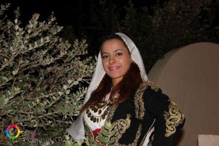
The position of women in Crete experienced many changes over the centuries, which sometimes raised her as a priestess and sometimes trapped in the house and considered…

The Maritime Museum of Crete is near the port of Chania, next to the entrance of the Firka fortress. The museum was founded in order to preserve the naval traditions…

Creta Ambulance was established with the aim of providing quality nursing services to patients in need of medical care, with an awareness of the sensitivity of…

Do only lichnarakia, anevata (i.e. traditional sweets with mizithra), Easter eggs and roasted lamb or antikristo (i.e. lamb cooked opposite the fire) define Easter…

Here is a very delicious recipe to treat your guests and, of course, to enjoy yourselves after the end of Lent. Kaltsounia are made in Crete during the holidays…

The fisherman that was the reason the traditional Cretan song “Stis Gramvousas to Akrotiri” to be created and sung was born at Vata of Lakonia in 1900. Nikolaos…

Mitato is a small stone-shaped building. Mitato you can find in the mountains of Crete and in Cyclades. These are buildings reminiscent of circular Minoan tombs…

A despot in the people’s hearts… Yes, that is love! It tears your heart out and leads it to unknown and dark paths that any logical person would not dare to follow.…

For 3 jars of one kilogram we will need: 3 pounds grapes 1.5 kg sugar 5 vanilla 3 branches of marjoram Juice of one lemon Clean and rinse the grapes. In…

Knossos was the centre of one of the most potent ancient civilisation of the entire world. The king of this period, Minos gave his name to this civilisation. Minos…

Kapetanakeio is one of the historical buildings of Heraclion that dominates in one of the most beautiful spots of the city. The 1stGymnasium of Heraclion, theoldest…

The flora of Crete is very important due to the mild and hot climate. There are 2000 different plant species and 160 of them are indigenous. The large number of…

Bougatsa is the sweet… custom of the New Year’s Day and Heraclion. Tones of bougatsa are consumed by the people of Heraclion in the night of the New Year’s Eve…

The Agiofarago climbing spot is in the Agiofarago gorge, in the south of the Heraclion prefecture, of Festos municipality. It is the southernmost climbing place…

The custom of Klidonas is rooted from the ancient times and mentioned in various texts of the ancient historians. The word “Klidonas” came from the ancient word…

The vineyard crop was an art coming from the Minoans since the First Minoan Years. About 4.000 years before, the grape was a necessary fruit in the diet of the…

The alcohol extracts were used in medicine and perfumery, in the ancient Greece. The traditional Cretan tsikoudia is a very famous product of the vineyard as, apart…

The Cretan honey was famous in all over the world from the ancient times due to its taste and its thyme (honey with thyme). Beekeeping in Crete has been popular…
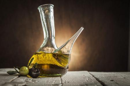
The olive production was recorded for the first time in the Minoan Crete, 3500 years ago. Findings like clay pots with olive oil and urns with edible olives in…

“The wine makes the poor rich in imagination and the rich poor in reality” Plato The wine in Crete has been produced since the Minoan Years. The Minoans cultivated…

The value of cheese has been appreciated by the ancient Greeks. The first references of goat and sheep breeding in Crete have been in the Greek mythology. Chased…

Sweets should be with a great smell, taste and appearance. How else would someone like them? Here is a very delicious recipe to treat your guests (and, of course,…

The weddings in Crete are a very important event not only for the couple and their parents but also for the whole community. All the people take part in the joy…
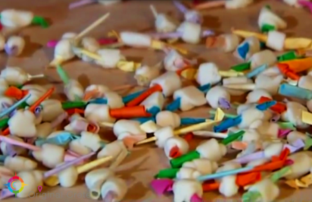
A tender and… sweet custom is kept till today in the area of Apostoloi Pediados. That is the sweet mantinades (i.e. Cretan folk couplets) custom that they are lyrics…
Mantinada is words combined in order to create a couplet with fifteen syllables and rhyming expressing feelings, thoughts or even the everyday life of the Cretans.…

The pure ingredients, produced by the fertile land of Crete combined with a fabulous way, are the feature of the Cretan diet that is famous for its wonderful tastes…

The dances of Crete are danced by men and women and remind the imposing and dynamic presence of the people of the island. The Cretan dances are divided into two…

A negative feature of the Cretan customs is vendetta, the revengeful murder that sooths the retributive justice. The law of retribution started to take place in…
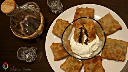
Small pies (fried pies) are often served in the houses of Crete that, apart from ksinomizithra (i.e. sarikopites) or sweet mizithra or herbs, they can be filled…

Chania is a modern city that coexists with the magic of the past. Wandering in the city, you can find buildings of the Venetian, Ottoman and traditional style.…

The Aradena gorge is one of the deepest and steepest gorges of Crete. Its height is 138 meters and the metal bridge built in order to connect the abandoned Aradena settlement…

In an area of 450 acres, very close to the town of Chania (about 9 km west), is the beautiful lake of Agia. The lake borrows its name from the neighbouring village.…

Just 8 km west of Chora of Sfakia, we find the award-winning coast, from the Times of London, Glika Nera.It was voted as one of the 20 most beautiful beaches in…

The Venetian Fragokastelo castle is in the Fragokastelo settlement, 12 kilometers in the east of Chora Sfakion, 140 kilometers in the south-west of Heraclion and…

Drosoulites and the place with the beautiful Venetian castle next to the Libyan Sea are in the area of Sfakia, in the south-western side of Crete of the Chania…

A unique beach, Seitan Limania, is in the north-eastern side of the Akrotiri peninsula, 20 kilometers from Chania. Lanes of steep rocks penetrate into the Cretan…

The picturesque Theriso settlement is on the foot of the Lefka Mountains, 16 kilometers from Chania, in a very green area. In order to visit it, you have to go…

The ancient city of Falasarna or Korikos was very developed commercially and its port was the main of Polirinia. The city flourished in the 4th and 3th century…

Falasarna with its awarded beach is about 60 kilometers in the west of Chania, in the western part of the Gramvousa Cape. The area is under the protected Natura…

The fortress of Gramvousa is on a steep hill of the Imeri Gramvousa Island, opposite the famous Mpalos beach. The building of the fortress started in 1584 by the…

One of the most famous monasteries in Crete due to its impressive architecture and the short distance from Elafonisi is the Panagia Chrisoskalitissa Monastery.…

The ruins of the fortress of Selinos are on the Fortetza hill, in the south of Palaiochora of Chania. It is a rectangle fortress, as that of Ierapetra, Meramvelo…

Palaiochora is a small coastal town about 70 kilometers in the south-west of Chania, built on a peninsula and between two bays. The settlement is on the ruins of…

The Kourna Lake is the unique natural fresh-water lake of Crete, 4 kilometers in the south of the coastal Georgioupoli settlement and 2.5 kilometers from the Kournas…
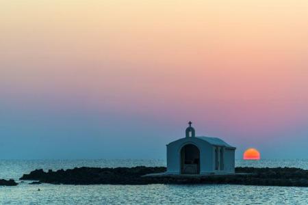
The coastal settlement of Georgioupoli is about 40 kilometers in the east of Chania and 20 kilometers in the west of Rethimno. Georgioupoli is under the Chania…

The semi-mountainous settlement of Vamos is in the former province of Apokoronas of the Chania prefecture and famous for maintaining its traditional features. The…

The twelfth route of the E4 European Long DIstance Path in Crete is 20 kilometers long and lasts about 8 to 10 hours. You can follow it from May to September, it…

The ruins of the Sfakia fortress are in the northern side of the settlement, on the Kasteli hill, next to a pine forest. The fortress is the last built by the Venetians…

The historical Chora Sfakion is in the southern coasts of Crete, 75 kilometers in the south-east of Chania. Sfakia has been always insubordinate and that was also…

The fourteenth route of the E4 European Long Distance Path in Crete is 18 kilometers and lasts about 6 hours. You can take it during the whole year, it is not a…

The eleventh route of the E4 European Long Distance Path in Crete is 15 kilometers and lasts about 7 hours. You can follow it from the end of spring till the beginning…

The tenth route of the E4 European long distance Path is about 18 kilometers and lasts 6 hours and 30 minutes. The time it has to be followed is from May to October(due…

The ninth route of E4 European Long Distance Path is 13,5 kilometers and takes 7 hours and 30 minutes to follow it. The best season of the time to follow it is…

The eighth route of the E4 European Long Distance Path is about 24,5 kilometers and lasts 8 hours. It is better to follow it in spring or autumn, it is not a difficult…

The seventh route of the E4 European Long Distance Path is 19,5 kilometers long and lasts 5 hours and 30 minutes, You can follow it during the whole year, it has…

The sixth route of the E4 European long distance path is about 13 kilometers and lasts 3 hours and 30 minutes. The best time to take it is the whole year and, especially…

The fifth route of the E4 European Long Distance Path in Crete is 20 kilometers long and lasts 8 to 9 hours. You should follow it from April to September and the…

The fourth route of the E4 European long distance Path is about 14,5 kilometers and lasts about 4 and a half hours. The ideal time of the year in order to visit…

The third route of the E4 European long distance path is about 22 kilometers and lasts 5 hours. Its best visiting time of the year is spring, summer and autumn.…

The second route of the E4 European long distance path of Crete is 32 kilometers and lasts about 8 hours. The ideal time to visit it is spring and autumn. There…

The E4 European long distance path of Crete starts from Kasteli Kissamou of the Chania prefecture. The total length of the Kasteli Kissamou-Sfinari route is about…

Martha is 54 kilometers from Heraklion, on the foot of the south-western edge of the Koupa hill of the Dikti Mountain. The village falls under the Viannos municipality…

The coastal settlement of Kokkinos Pirgos is 67 kilometers from Heraclion and 2, 5 kilometers from Timpaki. The area is very tourist. The visitor can stay in one…

Μili Gorge is the ideal choice for lovers of walking, nature and history. An easy route between lush vegetation, small lakes and waterfalls. It is a green oasis…

12km south of Anogia, at altitude of 1200m, you can find the beautiful church of the orthodox saint of Agios Yakinthos. The church is located in the middle of a…

The famous Tripa of Sfentonis (i.e. the hole of Sfentonis) or Tripa of Zou (i.e. the cavern of life) is 1 kilometer in the east of Zoniana, in the Rethimno prefecture.…

Opposite the Talay Mountains, where the mythical giant Talos was born and became the protector of the island of Crete, just 40km from the city of Rethymno, we meet…

The lake of Potamoi is in the Amari municipality, at the end of the Patsos gorge, in a very green valley with some hillocks next to it. The lake is about 25 kilometers…

One of the most beautiful gorges of the Rethimno prefecture, the Patsos gorge or the gorge of Agios Antonios of Patsos, is about 3 kilometers from the Patsos settlement…

The Kourtaliotis River is the most famous in Crete as the Preveli palm forest is near the place where it discharges. Kourtaliotis is called “Megalos Potamos” (i.e.…

The Monastery of Arkadi combines the natural beauty with its important history and legends. It is about 23 kilometers from Rethimno, in a very green plateau, in…

The Lappa ancient city was one of the most important cities in Crete that, according to the Mycenaean traditions, was founded by Agamemnonas. Lappa was in the place…

Argyroupoli is one of the most beautiful villages of the Rethimno prefecture, on the hill between the springs of the Petre and Mousela Rivers after which the names…

Panormo is a traditional, coastal settlement of the Milopotamos municipality and the Rethimno prefecture. The picturesque village is about 22 kilometers from Rethimno…

Mpali in the Rethimno prefecture is one of the most beautiful tourist places of the northern beaches of Crete. The coastal settlement is 32 kilometers from Rethimno…

The Idaion Antron is near the picturesque town of Anogeia with the important history and the impressive myths. The cavern is 1500 meters above the sea level and…
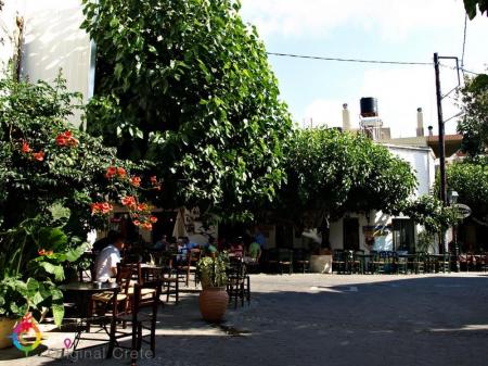
Anogeia of Milopotamos is a mountain town with important history and three holocausts. Anogeia preserves the Cretan tradition in the modern Crete. Anogeia is the…

Nida is the highest plateau in Crete as it is about 1.450 meters above the sea level and surrounded by the imposing mountains of Psiloreitis. It is a very beautiful…

The mountain and picturesque village of Apostoloi is about 30 kilometers from Rethimno. It falls under the Amari municipality of the Rethimno prefecture and the…

Spili is a traditional, mountain settlement of the Agios Vasileios municipality in the Rethimno prefecture. The settlement is built amphitheatrically, on the western…

Sellia is a village of the Agios Vasileios municipality and the Rethimno prefecture. Its local community is consisted of the settlements of Souda and Plakias. According…

Rodakino is one of the largest villages of the southern Rethimno prefecture. The village is on the foot of the Krioneritis Mountain, above the Rodakino beaches.…

The imposing Kourtaliotiko gorge starts from the Koksare village of the Rethimno prefecture, about 22 kilometers from Rethimno and ends to the amazing beach of…

The picturesque settlement of the Agios Vasileios municipality in the Rethimno prefecture, Sachtouria, is in a very beautiful area, in the north-western side of…

One of the most beautiful beaches of Crete is Agios Pavlos in the southern side of the Rethimno prefecture. It is 55 kilometers from Rethimno and, in order to visit…

Agia Galini is a very picturesque coastal settlement, 60 kilometers from Rethimno and about 70 kilometers from Heraclion. It “hangs” over the beautiful small port…

Neraidospilios is 20km south of Heraklion, in the green gorge of Astraki. According to the legend, in the Fairy Cave of Astrakas located in the gorge of Karteros,…

The Knosano gorge from where the E4 European Path starts is the natural continuation of the Holly Moutain, Giouchtas, in Ano Archanes. The gorge starts from the…

Minivan Cretan Transfer Services is a company offering private - high quality transfers with mini van on the island of Crete, Greece. Our services include airport…

Voni is famous for its religious tourism due to its female monastery in the village that is dedicated to Agia Marina. Administratively the village is under the…

Thrapsano, the center of pottery in Crete, is about 30 kilometers in the south-east of Heraclion. The settlement is under the Minoa Pediados municipality and 340…

The female monastery of Agia Marina is 500 meters from the Voni village, in a large valley of many vineyards. A large number of people visits the monastery every…

The picturesque and small settlement Tourloti is built on a Hill between the villages Kalivia and Tefeli. Tourloti is approximately 45 km from Heraklion city and…

The picturesque Karavados village is about 50 kilometers in the south-east of Heraclion and under the Minoa Pediados Municipality. 300 people live in the village…

Miliarades of the Viannos municipality is 53 kilometers from Heraklion, on the northern foot of the Koupa hill of the Dikti Mountain, 1188 meters above the sea…

The Pefkos village is on the southern foot of the Psari Madara hill of the Dikti Mountain, 2141 meters above the sea level and 10 kilometers from Ano Viannos. Pefkos…

The Emparos village is on the south-western foot of the Dikti Mountain, 430 meters above the sea level and the valley of the Mparitis River is around it. It is…

The picturesque Avli village of the Minoa Pediados is 35 kilometers from Heraclion. The Kassanoi settlement is under the Avli district. According to the 2011 census,…

Amiras or Amira is in the Viannos municipality, on the southern edges of the Dikti Mountain, 680 meters above the sea level, in a place full of olive and fruit-bearing…

Between Tsoutsouros and Kastri is the beautiful beach of Spilia tou Listi (i.e. thief's cavern). It is a beach that combines the sand with the great rocks and clear…

The historical and folklore Museum of Viannos was found in 1996 and exhibits many important objects. Some agricultural tools are exhibited and the professions of…

“Passers-by, when you go to Viannos, don’t walk on graves in order not to be burnt. Brothers were buried there that were fighting for freedom. They killed mothers,…

Kato Archanes is one of the most picturesque villages in the Heraklion prefecture with lots of alternative activities. Paths, small woods, archaeological sites…

The Archaeological Museum of Archanes is in a beautiful neoclassical building with 570 square meters area, in Tzami, in the center of the Archanes town. The small…

A walk in the beautiful, man-made small wood next to one of the most important archaeological sites in Crete would be a very good idea. Fourni is on a hill full…

“The other day, the three friends went a trip to a fine village known for its vineyards, about two hours from Kastro. It was on the foot of the Holly Mountain,…

The village Vorizia ( Voriza, in the past) is in the southern foot of Psiloreitis, 53 kilometers from Heraclion. Administratively the village is under Zaros of…

Agiofarago is one of the most impressive beaches in the Heraclion prefecture due to its imposing rocks that surround it, the pebbly coast and its crystal, emerald…

The beautiful and historical Agarathos Monastery is 380 meters above the sea level, in the south-western side of the Soros Panteli hillock of the Pediada district.…
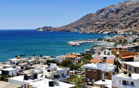
Sea, entertainment, archaeological sites, myths and legends are all in the coastal settlement of Tsoutsouras. The settlement is divided into two, Tsoutsouras and…

A museum with an exhibition of the copies of the work of Domenicos Theotokopoulos was found in 1998, in Fodele, the birthplace of the great painter. The El Greco…

The beatiful beach of Ligaria is 20 kilometers from Heraclion and 2 kilometers from Agia Pelagia. It is sandy and the sea water is blue and green. The beach is…

Psaromoura is one of the smallest and famous beaches of Agia Pelagia, 22 kilometers from Heraclion and 500 meters in the north of Agia Pelagia. In order to visit…

The picturesque Fodele settlement is on the 25th kilometer of the Heraclion- Chania national road, built in a very colorful landscape. Large trees, flowers, the…

The Venetian Mansion of Georgios and Fragiskos Modinos or the Tower of Kallergides is a preserved monument in Rodia of the Malevizi municipality. Georgios and Fragiskos…

Rodia or Rogdia is a picturesque settlement, built amphitheatrically on the sides of Marmarokefala, 300 meters above the sea level. Rodia with the panoramic view…

The Holly Monastery of Panagia Pantanassa is on the 14th kilometer of the Heraclion-Rethimno national road. The female monastery is dedicated to the Birth of Theotokos…

Palaiokastro or Paliokastro of the Malevizi municipality is a very interesting area, about 8 kilometers from Heraclion that combines the beach with the history…

Kalesia are two settlements, Kato and Ano Kalesia and the distance between them is 300 meters. Ano Kalesia is built 170 meters above the sea level and 300 people…

A small paradise on earth with tranquility, peacefulness and devoutness for the visitor is in the Savathiana Monastery, in Rogdia. The monastery is 20 kilometers…

Achlada is a village of the Malevizi municipality, 23 kilometers in the north-west of Heraclion. Administratively, the coastal settlements of Agia Pelagia, Ammoudi,…

Agia Pelagia is a coastal tourist resort, built amphitheatrically, in the west side of a large and beautiful peninsula, in which wonderful bays are shaped. It is…

The Psari Forada village is 90 kilometers from Heraclion and its natural extension is the Sidonia settlement. The rich valley that is divided in two parts with…

The gorge of Portela is one of the roughest and most impressive gorges in Crete. Experienced canyoners love it. Portela starts from the Chondros village of the…

Chondros is a village of the Viannos municipality and 64 kilometers from Heraclion. The long beaches are a feature of the district. Kastri (where the beach starts),…

Tertsa is a small but picturesque coastal settlement, 90 kilometers in the south-east of Heraclion and 25 kilometers in the south of Ierapetra. The village is in…

Keratokampos is a coastal settlement in the Viannos municipality. Apart from the beach of the settlement, that is 7 kilometers long, the Kavousi gorge also ends…

One of the most beautiful villages of the Viannos municipality, built in a very green area, is the Kato Simi village. Simi has the largest forest in the Heraclion…

Kastri, the coastal settlement of the Viannos municipality, is 70 kilometers in the south-east of Heraklion. Kastri has been connected with the Keratokampos settlement…

The Agios Antonios Monastery is built on imposing rocks in the exit of the Arvi gorge of the Viannos municipality. The monastery is justifiably described as Meteora…

Afrati is a small traditional settlement of the Viannos municipality, 45 kilometers in the south-east of Heraklion. 175 people live in the beautiful village with…

One of the most impressive gorges of Crete is that of Arvi, that cuts in the middle the Arvi Mountain and ends to the valley of the Arvi settlement. The gorge can…

Arvi is a coastal settlement of the Viannos municipality, 80 kilometers from Heraklion and 35 kilometers from Ierapetra. The settlement is in front of a valley…

The Natural History Museum works under the framework of the University of Crete and is on the Sofoklis Venizelos coastal Street. The exhibition of the museum is…

One of the most important museums of Greece, the Archaeological Museum of Heraklion, is in the north-east of the Eleftheria square. The building of the museum began…

The Historical Museum of Heraclion is in the coastal road, on the 27th of Sofoklis Venizelos Street. The Historical Museum of Heraclion was founded by the Society…

Every part of the capital of Crete, Heraclion, shows a different culture, every culture that flourished in there during the centuries. Every area travels you to…

The Voutes settlement is on a hillock with an amazing view of Heraclion and 12 kilometers from it. The Voutes district is also consisted of the Giofirakia settlement.…

Agia Eirini, the area with the dense plantation, is a few kilometers in the north of Heraclion. The settlement took its name from the small church of Agia Eirini…

One of the most important centres of the ancient civilization is 5 kilometres to the south-east of Heraklion in a green area with olive trees, vineyards and cypresses…

Festos was the second most important city after Knosos during the ancient years. The ancient city was built on a hillock and supervised the whole Mesara plain.…

Pitsidia is a touristic village, about 65 kilometers from Heraclion and a few kilometers from the coastal settlements of Kommos and Matala. Pitsidia is built 80…

Panagia is a picturesque –almost desolated- village of the Festos municipality. Panagia is built 380 meters above the sea level and in the south of Zaros. There…

The coastal Kalamaki settlement is 67 kilometers in the south of Heraclion, near Matala and ancient Festos. The longest beach of the south Crete is in Kalamaki…

The female monastery of Panagia Kaliviani is in the 60th kilometer of the road from Heraclion to Timpaki, turning right in a fork. It is built 80 meters above the…

Ano Moulia is a picturesque, mountain village, built amphitheatrically, with a panoramic view to the Mesara plain. The village of the Gortyna municipality is 35…

The Lavirinthos Musical Workshop is hosted in an old mansion in the square of Choudetsi in the facilities of which a unique (in Greece) museum with traditional…
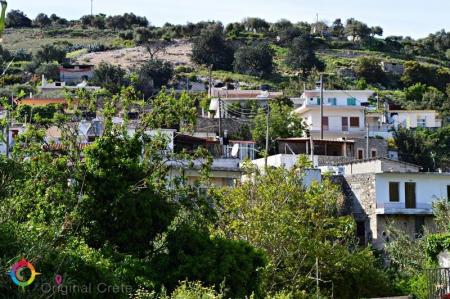
Choudetsi has been developed into a cultural center of Crete during the last years. The village is in the valley that the Lagnos, Korfi, Skala and Vigla Mountains…

The Treis Ekklisies (i.e. three churches) coastal settlement is behind the imposing Asterousia Mountains in the end of the Ampas gorge. It is an area that makes…

The impressive Ampa gorge is near Pananimfoi, in the Arxanes-Asterousia Municipality. Ampas is known to the locals for its natural beauty that includes also the…
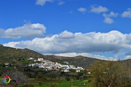
Paranimfoi is a picturesque, mountainous village in the east of Kofinas, with magnificent view to the Libyan Sea. Administratively the settlement is under the Archanes-Asterousia…

The picturesque Panagia Spiliotissa monastery is between Agios Vasileios and Choudetsi and 22 kilometers from Heraclion. In order to reach the monastery, you have…

Agioi Deka is one of the most important villages in Mesara archaeologically and the ruins of the ancient city of Gortyna are there. The settlement is built on the…

The archaeological site of the ancient city of Gortys or Gortina is 45 kilometers in the south of Heraclion, in the west side of the Agioi Deka settlement. The…

The path in the Agios Charalampos gorge is a part of the E4 European long distance route. Following the route, you can go through the impressive Agios Antonios…

The gorge of Venerato is a very small gorge, 500 meters long and with a natural beauty. The gorge is between Venerato and the Paliani Monastery and 17 kilometers…

Siva is a village of the Heraclion municipality, 280 meters above the sea level. 260 people live in the settlement and their main occupations are olive crop and…

The Kerasia settlement is built on the eastern sides of the Chalepa hill, 340 meters above the sea level, on the 20th kilometer of the national Heraclion-Mesara…

The Paliani Monastery is near and under Venerato of the Heraclion municipality and is one of the oldest monasteries in Crete. The female monastery is from the First…

Venerato is a village of the Heraclion municipality, 20 kilometers from the Heraclion city. Administratively the district is consisted of Venerato, the Paliani…

Avgeniki is a village of the Heraclion municipality, on the 20th kilometer of the Heraclion-Timpaki road. The entrance of the Venerato gorge is near the settlement…

The beautiful and traditional buildings and the two flour-mills in Kazola are worth visiting in Pirgou. Pirgou is 20 kilometers from Heraclion where, administratively,…

“… on the lap of the mountain and hidden from the sun is the large village of Petrokefalo” wrote N. Kazantzakis, in his book, “Kapetan Michalis”. Petrokefalo is…

Pentamodi is a quiet and picturesque village in the valley of the Gazanos River, 17 kilometers from Heraclion. Administratively, the village is under the extended…

Kato Asites is a beautiful, mountain village on the foot of the Psiloreitis Mountain, 450 meters above the sea level. The distance of the village to Heraclion is…

The Monastery of Agios Georgios Gorgoleimon is on the foot of the Koudouni Mountain, 500 meters above the sea level, near the Kato Asites settlement. The monastery…

The Folklore Museum of Ano Asites was created in order to preserve and spread the manners and customs of the area. The building of the museum was bought by the…

Ano Asites is a settlement of the former Malevizi district of the Heraclion municipality. It is a village of a high environmental, cultural and archaeological interest.…

The Agios Mironas settlement is exquisite for its architecture and its cultural activities. Administratively, the village is under the former Malevizi district,…

Voulismeno Aloni is a sightseeing of the area on the road to Damasta. It can be seen after about 5 kilometers, in the right side of the road and is a big crater…

Tilisos is built on the ruins of the ancient city of Tilisos and is in the eastern foot of Psiloreitis. The name of the settlement has been used for over 3.400…

The small, picturesque settlement of Moni is about 17 kilometers from Heraclion, on the 1st kilometer of the Tilisos-Anogeia road. Moni is a village of the Malevizi…

The mountainous Marathos village of the Malevizi municipality is about 20 kilometers from Heraclion and 300 meters above the sea level. The Marathianos River is…

The mountain village of Damasta is about 27 kilometers from Heraclion and under the Malevizi municipality. Damasta is built on the northern sides of the Koiti hill,…

Faneromeni is a village of the Festos municipality and 4 kilometers from Timpaki. The Faneromeni local community also includes Kalivia and the Kaliviani monastery.…

The man made dam of Faneromeni is between the villages of Zaros and Timpaki, in an area with dense plantation, in the southern foot of Psiloreitis, beneath the…

Skourvoula of the Festos municipality is built on the southern foot of Sanidas Mountain, 350 meters above the sea level, with a panoramic view of the fertile Mesara…
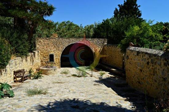
Sivas is one of the most beautiful villages in the Festos municipality, in the south-west side of Mesara plain. The settlement is built 110 meters above the sea…

Pompia is one of the most beautiful and important villages in the Festos municipality. It is in an area full of olive groves and vineyards, next to the imposing…

Platia Peramata is a small settlement in the middle of the dirt road that connects Kaloi Limenes with Lentas. The settlement is 70 kilometers from Heraklion. A…

Petrokefali of the Festos municipality is a beautiful village with recently renovated rock houses and 59 kilometers from Heraclion. There are many coffee houses…

Moires is the seat of the Festos municipality. It is a large town of the former Kainourio district, 53 kilometers from Heraklion and built in the Mesara plain,…

The village of hippies, Matala, is approximately 70 kilometers in the south of Heraclion and is one of the most famous coastal settlements of the southern Crete.…

The small village of Magarikari is on the western foot of Psiloreitis. Magarikari is built 450 meters above the sea level and, from there, you can admire the Kato…

The two Towers of Kourmoulides are in Kouses of Festos municipality. The Towers belonged to the Kourmoulis family who were Crypto- Christians and helped Christians…

Kouses is a historical village of the former Kainourio district and of the Festos municipality. The village is on the northern foot of the Pirgos hummock of the…

The ruins of Castle Nuovo are in the Psilo Kastelli hill, in the south-west of the Kastelli settlement, in the Festos municipality. The fortress was built by the…

Kastelli, in the former district of Kainourrgio, in the Festos municipality, is in the southern foot of Psiloreitis, very close to the fortress of Castel Nuovo.…

The path from the Kamares settlement ends to the large and impressive Kamares cavern. The visitor walks between a dense forest of oaks. The total time to the end…
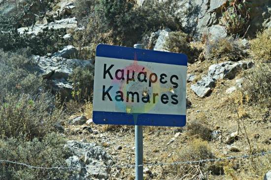
Kamares of the former Pirgiotissa district and of the Festos municipality is in the southern foot of Psiloreitis. 437 people live in the village according to the…

Many beautiful and clean beaches are in Kaloi Limenes. Kaloi Limenes is 77 kilometers from Heraclion and it can be accessed by the asphalted road that goes through…

The beautiful male monastery of Odigitria is in the western end of the Asterousia Mountains, 250 meters above the sea level, near Agiofarago and Martsalo. The area…

The male monastery of Vrontisi is in the southern foot of Psiloreitis, between the villages of Zaros and Vorizia, 550 meters above the sea level. Administratively…

The monastery of Varsamoneri is one of the oldest monasteries in Crete, as it is from the first years of the Venetian occupation. The temple (with 3 aisles) dedicated…

The path to the green gorge of Agios Nikolaos with the amazing waterfalls starts from the Zaros Lake and ends to one of the forest of Greece, the Rouvas forest.…

The restored water mill of Mix. Fragiadakis is in Zaros on the road that starts from the Votomos man-made lake. It has declared a preserved historical monument…

The beautiful and interesting town of Zaros is built 45 kilometers from Heraclion and is included in the Festos municipality. It is in the southern foot of the…

The Cretan Ethnology Museum was found in 1982 in Voroi. It is a very important exhibit, research and conference constitution that aims to the substantial outlining…

A very traditional and of high cultural importance village, Voroi, is 2-3 kilometers from Festos in the fertile plain of Mesara. Administratively Voroi falls under…

The entrance of the gorge of Vorizia is in a dense planted area full of oaks, in the east of Vorizia. The gorge ends to the amazing landscapes of the Nida plateau.…

Alithini is a small village in the former district of Kainourgio, in the Gortyna municipality. The settlement is 150 meters above the sea level. 150 people live…

Sternes is a village of the Gortyna municipality, 55 kilometers from Heraclion. The settlement is built on the northern foot of the Asterousia Mountain, 310 meters…

Stavies, in the Gortyna municipality, is a settlement where many interesting cultural events are taken place in the summer. Stavies is 60 kilometers from Heraclion…

The picturesque village of Sokaras is 50 kilometers from Heraclion between olive trees and fertile vineyards and garden produce of the plain of Mesara. Places of…

The ruins of the ancient city of Rizinia are on the Patella hill, 2 kilometers from Prinias. The city flourished as an independent community from the Sub-Minoan…

Prinias is a village of a high archaeological importance in Crete and one of the most beautiful settlements of the prefecture of Heraclion. It is 25 kilometers…

Platanos of the Kainourio district and the Gortyna municipality is 51 kilometers from Heraclion, 100 meters from Mesara plain. Two tombs have been excavated from…

Panasos is a small, picturesque village of Gortyna municipality. It is 35 kilometers from Heraclion and 450 meters above the sea level. The beautiful settlement…

“I don’t believe that there is any village like Nivritos in a place full of flowers and near mountains”. The picturesque village is on the foot of the Ampelakia…

Megali Vrisi is about 30 kilometers from Heraclion, in the north side of the basin of the Monafatsi district. The settlement is built amphitheatrically, 620 meters…
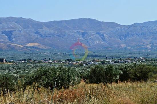
Loures, the village of the Gortyna municipality, is in the northern edge of the Mesara plain, 54 kilometers from Heraclion. Loures are 270 meters above the sea…

The coastal settlement of Lentas, of the Gortyna municipality, is built on the ruins of the ancient city of Levin ( «Λεβήν»). Lentas is in the southern sides of…

A Middle and Post Minoan settlement and a Protopalatial cemetery were found in Koumasa, the two-peaked hill of Korakies. There are four tombs (three vaults and…

The small settlement of Koumasa is famous for the imposing gorge of Agios Savvas that starts from the southern side of the village and it is 4 kilometers long.…

“In Kapetaniana, whoever believes in God, he talks to Him”, Thanos Mikroutsikos. A heaven on Earth is in the holly hill of Kofina and stares the Libyan sea. Kapetaniana…

The old monastery of Panagia Kardiotissa is in a magnificent and verdant area. Some kilometers before the village of Agios Thomas (coming from Heraclion), in the…
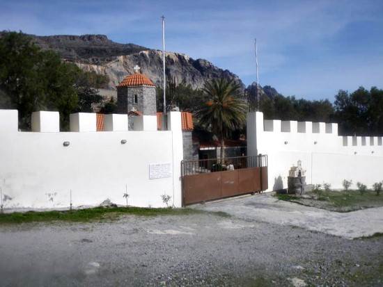
A magnificent path starts from the picturesque, mountainous village of Paranimfi and ends in the monastery of Koudoumas. The hiking takes many hours but the exploration…

In front of the monastery of Koudoumas is a beautiful and very clean beach. You can enjoy swimming in the cool water of the sea as long as you respect the area…

The monastery of Koudoumas is very well protected by the imposing Asterousia Mountains, in the south of the cape of Martelos, and by the Libyan sea in the south.…

Dionisi is a small, picturesque village of the Gortyna municipality and 57 kilometers from Heraclion. The settlement is built on the northern foot of Asterousia…

The Local and Natural History Museum of Gergeri was found in 1996 to record, study and make the characteristics of the natural environment known. Another reason…
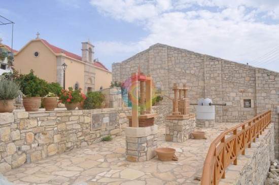
The Open Museum of Elia is in the yard of an old mill that is called “Mesakos”, in Gergeri. There are some reconstructed oil presses and presses from the Minoan…

The two lakes of the area are about 1 kilometer from Gergeri on a hill with a wonderful view. The one is a man-made water reservoir lake and the other a small,…

Gergeri is a large village in the southern foot of Psiloreitis and is built between impressive and steep cliffs. The wonderful forest of Rouvas is above the village.…

The Vasiliki village is near the Asterousia Mountains, 260 meters above the sea level and 56 kilometers from Heraclion. The Vasiliki community includes Vasiliki…

On the foot of the Asterousia mountains, from where the Xilvestra torrent of the Geropotamos tributary is, the village of the Gortyna municipality, Vagionia…

Asimi is in the Gortyna municipality and a modern town that serves the commercial, banking and other needs of the residents of the area. It is on the watershed…

Ano Akria is a village of the Gortyna municipality. The settlement is 40 kilometers from Heraclion and built on the semi- mountainous area of the hummock of the…

The cave of Agios Antonios is in a lonely area at about the middle of the path that connects the settlement of Agios Ioannis with the monastery of Koudoumas. If…

The path which connects the monastery with the coastal settlement of Agios Ioannis is in the west of the monastery of Koudoumas. The route is easy and lasts about…
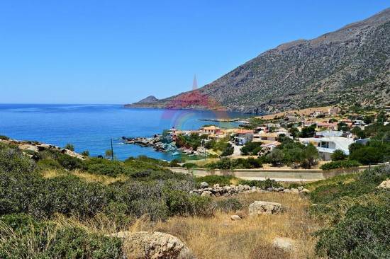
The settlement of Agios Ioannis is a few meters from Kapetaniana, after a winding, dirt road. It its built along the Ponta peninsula . A wonderful beach with blue…

The Melissa fortress in near the settlement of Agios Thomas, on the top of a hill with a magnificent view. It is one of the largest fortifications of the inland…

The most impressive tomb of Crete is in Agios Thomas, in Gria Mantra. The monolithic Roman tombs are preserved in a very good condition. The path in the south of…

Agios Thomas is a place with an imposing landscape, dense vegetation and a magnificent view. The carved winepresses, the Roman tombs, the Melissa fortress, the…

Agia Varvara, of the Gortyna municipality, is the longest village in Crete. The village is built along the road of Heraclion to western Mesara. The distance between…

Charaki is about 35 kilometers from Heraclion and 350 meters above the sea level. Administratively, the village is under the Archanes-Asterousia municipality and…

Tefeli is about 12 kilometers from Pirgos and, administratively, it comes under the Archanes- Asterousia municipality. Aposelemi and Pirathi fall under the local…

Pretoria is a beautiful traditional village with paved alleys and yards full of many different flowers. The village is in the rich plain of Mesara between olive…

Peza of the Archanes- Asterousia municipality is famous for their agricultural tradition. Peza is built between many vineyards and olive trees, is 17 kilometers…

The museum of one of the most important modern writers is in Mirtia, 20 kilometers from Heraclion. Nikos Kazantzakis is recognized as the writer with the most translated…

“ The family of my father comes from a village two hours from Megalo Kastro and is called Varvari “ Nikos Kazantzakis wrote in his book “Anafora ston Greko” and…

The picturesque village of Metaxochori is built in the foot of a hill, 420 meters above the sea and 34 metres from Heraclion. The village belongs to the Archanes-Asterousia…
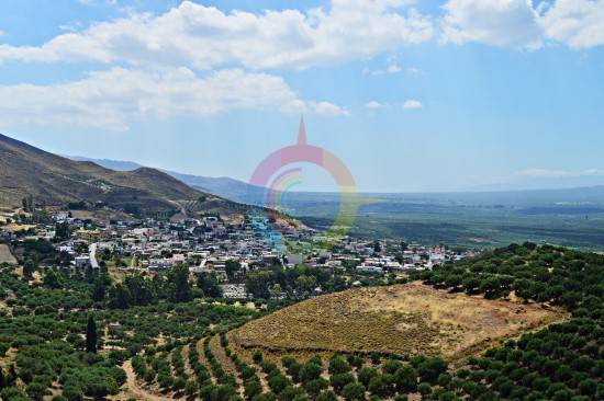
The large village of Mesochorio is in the foot of the Asphentilias hummock in the Asterousia mountains. The settlement is about 55 kilometers from Heraclion. The…

The fortress Castello di Beto stands as a guard on the top of the Kastellos hillock, east of the Melesses settlement. The ruins of the medieval fortress are preserved…

The beautiful village of Melesses in the Archanes-Asterousia municipality gives a colorful touch from the mediaeval pattern. Nature has given the most beautiful…

The coastal settlement of Maridaki is about 65 kilometers from Heraclion, behind the Asterousia Mountains. The small village is built at the end of the imposing…

Ligortinos is a traditional village which is built 380 meters above the sea level. The beautiful view with the tiled alleys and the magnificent monuments, like…

Kounavoi, the traditional village of Archanes-Asterousia Municipality, is where the Minoan city of Eltinia was. The settlement dominates in a small plain in the…

The picturesque village is on the top of a hillock next to the Anapodaris river and 240 meters above the sea level. Administratively it falls under the Archanes-…

The male monastery of Agios Georgios Epanosifis is one of the most important monasteries in Crete for its spiritual and social offer. The monastery is 30 kilometers…

The beautiful and lonely beach of Agios Nikitas is behind the Asterousia mountains in the bosom of the southern Cretan sea. In order to visit the beach, you should…

The monastery of Agios Nikitas is about 65 kilometers in the south of Heraclion behind the the imposing Asterousia mountains. Administratively, the monastery falls…
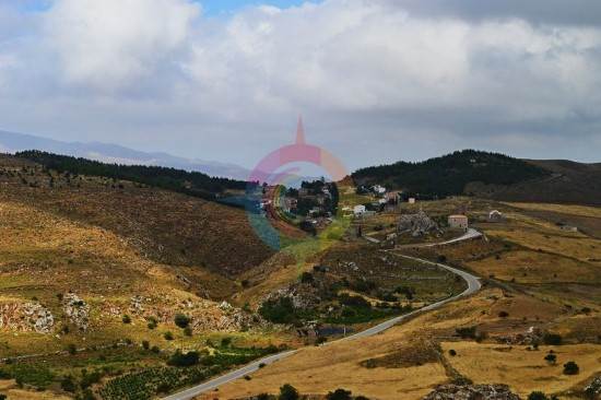
One of the most beautiful and traditional Cretan villages of Crete is Ethia in the Archanes-Asterousia Municipality. The village is about 55 kilometers from Heraclion,…

The lake of Damania is near the Damania settlement, in Archanes-Asterousia municipality and the prefecture of Heraclion. The dam gives the landscape an extra touch…

The small settlement of Damania is about 35 kilometers from Heraclion, built in the Southeastern sides of Ofis hummock and 420 meters above the sea level in the…

The beautiful gorge of Achentrias crosses the Asterousia mountains and reaches the Cretan sea. The Achentrias gorge starts from the settlement of Achentrias and…

In Achentrias the visitor can admire the many caverns of the Asterousia mountains. The most typical examples are the Archontospilios cave, in Agios Nikitas, and…

In the Achentrias settlement, in the Archanes-Asterousia municipality of the prefecture of Heraclion, there are many hiking options. You can either wander in the…

The lake of Tourkos (i.e. Turk) or Lakos or Kolimpas, a unique natural lake, is at the top of Asterousia mountains, near Achentrias. The lake has a lot of water…
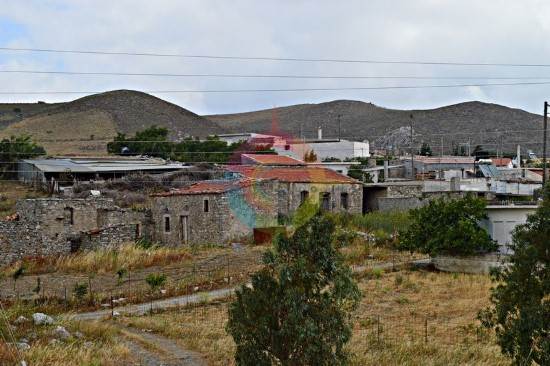
The picturesque mountainous village of Achentrias is 60 kilometers from Heraclion and 680 meters above the sea level. Administratively, it falls under the Archanes-Asterousia…

In Kato Vrisi, in Astritsi, someone can find a forgotten part of the paradise. Administratively, Astritsi belongs to the Archanes- Asterousia Municipality,…

Astraki is famous for its beautiful gorge that goes by the same name and it starts from there and also for the old Turkish quarter. The village is from the 12th…

The Tholi fortress was built in the last Venetian period, between 16th and 17th century. The Venetian fortress is in the west of the settlement of Alagni, on the…

Alagni is a village in the Archanes- Asterousia Municipality and is closely connected to mythology, history and tradition. Alagni is 25 kilometers from Heraclion,…

Agies Paraskies is built on a 360-meter hummock with a magnificent view. It is 20 kilometers in the south east of Heraclion and, administratively belongs to the…

Buildings that make you feel like you live in other times, fountains that were a source of dew for the residents and 19 churches reminiscent of the old prestige…

Architectural diamonds, verdant colorful courtyards, and scenic alleys are some of the features of Kastelli in the municipality of Agios Nikolaos that will be of…

A Minoan and a Roman mansion have been found in the south-eastern coastal Makris Gialos settlement of the Lasithi prefecture. The Minoan mansion was found in Plakakia.…

The monastery of Agios Ioannis Kapsa is built 9 km east of Makris Gialos, west of the gorge of the Perovollakis. It is a double cave temple dedicated to St. John…

About 5 km west of Ierapetra and 39 km south of Agios Nikolaos, we find the seaside village of Gra Lygia, famous for the fertile valley in which locals grow in…

The Milatos cavern is a few kilometres in the north-east of the Milatos settlement of Agios Nikolaos, in the Lasithi prefecture. A memorial of the thousands of…

The picturesque Oropedio (i.e. plateau, in Greek) of Lasithi is the largest and the most fertile plateau of Crete and one of the most important places of Crete…

The Preveli Monastery is about 35 kilometers in the south of Rethimno and the famous and beautiful palm forest is next to it. The monastery is in the west of the…

Kserokampos is one of the most beautiful beaches of the eastern Crete. Kserokampos is a settlement about 48 kilometers from Siteia and 28 kilometers from Palaikastro.…

The Toplou Monastery, one of the largest and most important monasteries in Crete, is in the Kavo Sidero Cape, 10 kilometers in the east of Sitia and 6 kilometers…

The impressive cavern of Pelekita or “tis Sikias o Spilios” is one of the biggest caverns in Crete and of a high archaeological importance. It is about 5 kilometers…

The gorge of Nekroi in Zakros is a very beautiful and important archaeologically gorge. Its name (“nekroi” means the dead, in Greek) came from the large number…

The Minoan Palace of Zakros is the fourth largest ancient palace in Crete after those of Knosos, Festos and Malia. It is 500 meters from Kato Zakros, 8 kilometers…
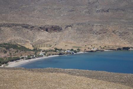
The calm Kato Zakros beach is behind mountains and the plants of the green valley of Zakros. The beach is pebbly and at the edge of the large bay. It is not organized…

Zakros is one of the most picturesque villages of Crete that combines the natural beauty with the alternative activities and the important archaeological sites.…

The Cha gorge of the Ierapetra municipality and Lasithi prefecture has about 25 descents, slides and jumps. Water dominates and creates many waterfalls and places…

The gorge of Sarakina or Sarantapichos starts from the Mithoi settlement of Ierapetra and ends to the coastal Mirtos settlement. Its entrance is about 16 kilometers…

Mirtos is a picturesque and tourist coastal settlement of the Lasithi prefecture. It is built near the banks of the Krios River, close to the exit of the imposing…

Makris Gialos is a small coastal settlement 24 kilometers in the east of Ierapetra, 35 kilometers in the west of Siteia and 60 kilometers from Agios Nikolaos. Makris…
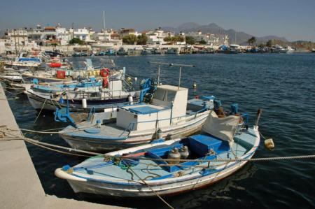
The Archaeological Museum of Ierapetra has been working since 1986 in the Commercial Ottoman School in the center of the city. The exhibits concern the area and…

The Venetian Kales fortress is in the southern part of the Ierapetra port. It possibly began to be built in 1212 by the Genovese pirate Pescatore. The first written…

The ancient Lato city was about 3 kilometers in the north of Kritsa of the Agios Nikolaos municipality, in Lasithi. It was protected due to its geographical position…

The awarded city for its wonderful beaches, Ierapetra, is the unique city in the southern Crete and the last city in the southern end of Europe. Ierapetra is about…

The island of the tears and the island of the leppers are some of the characterizations of the beautiful and historical Spinaloga. Spinaloga is in the north of…

The Kritsa gorge is in a very beautiful area. It starts from the north-east side of the Kritsa settlement and ends after about 12 kilometers, to the Tapes village.…

The picturesque and beautiful Kritsa village with important archaeological findings is in the Agios Nikolaos municipality of the Lasithi prefecture. The village…

The amazing and magnificent Elounta is known for the powerful and famous people from all over the world that visit it. Its beaches, its clean, blue sea, and the…

The Folklore Museum of Agios Nikolaos is in one of the oldest buildings of the city, next to the bridge of the lake. It opened in 1978 in order to maintain the…

The Archaeological Museum of Agios Nikolaos has been working since 1970 and is one of the most important museums in Crete. It is in the northern part of the lake,…

Agios NIkolaos, the beautiful capital of the Lasithi prefecture, is in the west side of the Meramvelo peninsula. The Voulismeni Lake in the center of the city is…