Villa Iasonas
An old residence renovated completely in 2015 is between the old stone houses of the traditional settlement of Kournas Apokoronas. Villa Iasonas keeps the traditional…
246 results found
An old residence renovated completely in 2015 is between the old stone houses of the traditional settlement of Kournas Apokoronas. Villa Iasonas keeps the traditional…

A stunning route who combine the tradition of the island, the beautiful beaches, the legends and the beauty of mother nature. This route with starting point...

From ancient Gortyna to the picturesque village of Sivas, from Sivas to the historic and beautiful monastery Odigitrias and from the monastery Odigitrias to...

Location Chania, Crete Population 53,000 inhabitants Architecture A blend of Venetian, Ottoman, and traditional architecture Old and Modern City Chania is divided…

Location 75 km from Heraklion, 13 km from Lentas Access Dirt road from Krotos village, 4 km to the hill, 10-minute walk to the church Tradition Miraculous…

Location 50 km south of Heraklion, at the foot of the Asterousia Mountains Population 1,000 residents (2011 census) Landmark The "Charaki" rock with…

Location 15 km from Heraklion Altitude 360 m. Activities Hiking on the E4 trail, visit to the Museum of Cretan History Sights Archaeological site in Fourni, amazing…

The Archaeological Museum of Archanes is in a beautiful neoclassical building with 570 square meters area, in Tzami, in the center of the Archanes town. The small…

Location 16 km from Heraklion Αltitude 380 meters Awards "Integrated Sustainable Settlement Development" Award (2000), Gold Environmental Award…

One of the most important museums of Greece, the Archaeological Museum of Heraklion, is in the north-east of the Eleftheria square. The building of the museum began…

The gorge starts from the small Agios Charalampos church in the south of the Ano Asites settlement. The small gorge is easily accessed, particularly in the summer,…

Charaki is about 35 kilometers from Heraclion and 350 meters above the sea level. Administratively, the village is under the Archanes-Asterousia municipality and…

The Cha gorge of the Ierapetra municipality and Lasithi prefecture has about 25 descents, slides and jumps. Water dominates and creates many waterfalls and places…
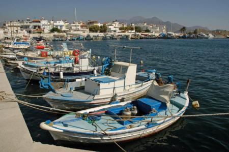
The Archaeological Museum of Ierapetra has been working since 1986 in the Commercial Ottoman School in the center of the city. The exhibits concern the area and…

The Archaeological Museum of Agios Nikolaos has been working since 1970 and is one of the most important museums in Crete. It is in the northern part of the lake,…

Do only lichnarakia, anevata (i.e. traditional sweets with mizithra), Easter eggs and roasted lamb or antikristo (i.e. lamb cooked opposite the fire) define Easter…

River is a system of internal water that flows on the surface of the earth and a large of its part can be underground. Very few rivers are in Crete due to its small…

Mitato is a small stone-shaped building. Mitato you can find in the mountains of Crete and in Cyclades. These are buildings reminiscent of circular Minoan tombs…

Crete has been popular for summer holidays but that is not only the case. Crete is also a winter destination just as any other in the world. Crete, the island of…

Here is a recipe of the “queen” of the vegetables, eggplant, that comes from Turkey and we "made" it Greek through small changes. According to history, the name…

For 3 jars of one kilogram we will need: 3 pounds grapes 1.5 kg sugar 5 vanilla 3 branches of marjoram Juice of one lemon Clean and rinse the grapes. In…

Kapetanakeio is one of the historical buildings of Heraclion that dominates in one of the most beautiful spots of the city. The 1stGymnasium of Heraclion, theoldest…

The flora of Crete is very important due to the mild and hot climate. There are 2000 different plant species and 160 of them are indigenous. The large number of…

Bougatsa is the sweet… custom of the New Year’s Day and Heraclion. Tones of bougatsa are consumed by the people of Heraclion in the night of the New Year’s Eve…

The custom of Klidonas is rooted from the ancient times and mentioned in various texts of the ancient historians. The word “Klidonas” came from the ancient word…
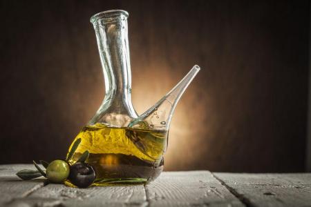
The olive production was recorded for the first time in the Minoan Crete, 3500 years ago. Findings like clay pots with olive oil and urns with edible olives in…
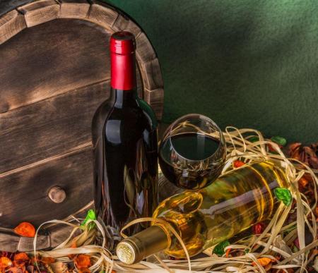
“The wine makes the poor rich in imagination and the rich poor in reality” Plato The wine in Crete has been produced since the Minoan Years. The Minoans cultivated…

The value of cheese has been appreciated by the ancient Greeks. The first references of goat and sheep breeding in Crete have been in the Greek mythology. Chased…

Prostitutes, rebetes and mages were the residents of the Lakkos neighbourhood. In Lakos, there were weird feasts, hashish making and other illegal acts that could…

The pure ingredients, produced by the fertile land of Crete combined with a fabulous way, are the feature of the Cretan diet that is famous for its wonderful tastes…

Being friendly, with interesting views and a restless spirit is maybe the other side of Ross Daly, the musical traveler. We met him in the Lavirinthos Musical Workshop…

The dances of Crete are danced by men and women and remind the imposing and dynamic presence of the people of the island. The Cretan dances are divided into two…

Have you wondered the importance of sariki (i.e. kerchief with fringes)? Why do the Cretans wear a black shirt? Which are the influences of the traditional Cretan…

The Cretan dialect includes words that came from and were influenced by the various nations inhabited in Crete that were adapted and changed in order to have the…
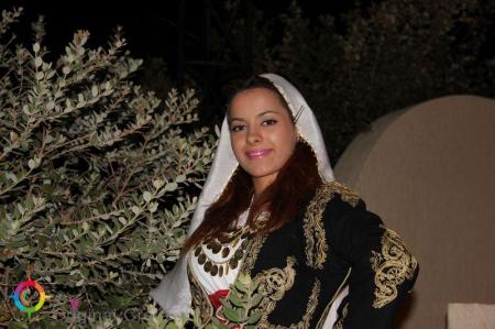
The position of women in Crete experienced many changes over the centuries, which sometimes raised her as a priestess and sometimes trapped in the house and considered…

Location: 50 km from Chania in the village of Topolia Chapel of Agia Sophia Inside the cave is a charming chapel dedicated to Saint Sophia Natural Decor: The…

Location Emprosnero, Municipality of Apokoronas, 40 km from Chania History Built by Venetians, reconstructed by Turks, destroyed by Sfakians in 1774 Architecture Four…

Location Tavris Plateau near Askifou Altitude1,200 m Access 7.5 km dirt road or a 2-hour hike from Ammoudari Facilities 45 people capacity,…

Location Southeast of the Omalos Plateau, at an altitude of 1,680 meters View Panoramic views of the Cretan and Libyan Seas, the Samaria Gorge, and Gavdos…

Location 26 km east of Chania Access Through the village of Palailoni Parking Small parking area near the beach Natural beauty Impressive cliffs…

Location Between the villages of Vryses and Maza Access Chania-Rethymno National Road Other attractions Lush vegetation, springs, and the chapel…

Location Aradena Gorge is located in Sfakia, Crete, and extends from the abandoned village of Aradena to the sea Length The gorge stretches over approximately…

The Maritime Museum of Crete is near the port of Chania, next to the entrance of the Firka fortress. The museum was founded in order to preserve the naval traditions…

Location Lake Agia is located 9 km west of Chania Size It covers an area of 450 acres Origin The lake is artificial and named after the nearby village…

The Venetian Fragokastelo castle is in the Fragokastelo settlement, 12 kilometers in the east of Chora Sfakion, 140 kilometers in the south-west of Heraclion and…

Location South of Sfakia, 75 km from Chania. Historical Interest Venetian castle and the legend of the Drosoulites. Beaches Main beach, Orthi Ammos,…

Location 20 km from Chania, northeastern Akrotiri Peninsula Access From Chordaki, 10-15 minute hiking trail Facillities No organized facilities Name derived from…

Location 16 km from Chania, nestled at the foot of the White Mountains Main Attractions Theriso Gorge, Cretan Revolution Museum, Venizelos’ headquarters…

Location Western Crete, Gramvousa Peninsula Timeline 4th and 3rd centuries BCE Significance Major trade hub, connected with Alexandria Currency Featured a woman’s…

Location 60 km west of Chania, Crete Beaches Award-winning Pachia Ammos, other smaller beaches to the north and south Activities Windsurfing, water sports Archaeology…

The fortress of Gramvousa is on a steep hill of the Imeri Gramvousa Island, opposite the famous Mpalos beach. The building of the fortress started in 1584 by the…

Location 72 km southwest of Chania, overlooking the Libyan Sea Architecture A dazzling white monastery with fortress-like architecture perched on a 35-meter…

Location On Fortetsa Hill, south of Paleochora, Chania Construction Built in 1279 by the Venetians to control the surrounding region and the sea route…

Location 70 km southwest of Chania, built on a peninsula between two bays Sights the Venetian fortress of Selino, the Museum of the Akrites of Europe…

Location 4 km south of Georgioupolis, on the border of Chania and Rethymno History Ancient name "Korisia," current name from the Arab period Dimensions 579…
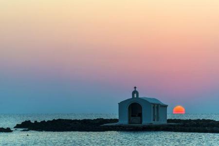
Location 40 km east of Chania, 20 km west of Rethymno Rivers Almyros and Perastikos, contributing to the natural lake and lush vegetation Beach 10…

Location 26 km southeast of Chania Architecture Traditional kamarospita and konakia, built using local materials Attractions Old neighborhood, restored…

The twelfth route of the E4 European Long DIstance Path in Crete is 20 kilometers long and lasts about 8 to 10 hours. You can follow it from May to September, it…

Location 71 km south of Chania Access By foot or boat from Sfakia, Agia Roumeli, Sougia, Paleochora, Gavdos. History Connected to the ancient city…

Location 58 km south of Chania Natural Environment Exit of the Samaria Gorge Access By hiking or sea transport Beaches Main beach split…

Location 42 km south of Chania city Length 18 kilometers, with a hiking duration of 4-8 hours National Park Declared in 1962, part of the UNESCO…

Location North of the Sfakia settlement History Built in the 15th-16th century by the Venetians Destruction Destroyed by the Sfakians after a conflict…
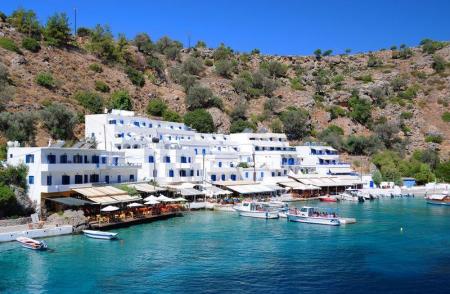
Location 2 km east of Chora Sfakion Natural Landscape Rocky terrain, steep cliffs, rich flora with holm oaks, pines, cypresses, and stone pines Hiking The…

Location 75 km southeast of Chania History Unsubdued by conquerors from the Arab period through the Turkish occupation Activities Hiking on the E4…

The fourteenth route of the E4 European Long Distance Path in Crete is 18 kilometers and lasts about 6 hours. You can take it during the whole year, it is not a…

The eleventh route of the E4 European Long Distance Path in Crete is 15 kilometers and lasts about 7 hours. You can follow it from the end of spring till the beginning…

The tenth route of the E4 European long distance Path is about 18 kilometers and lasts 6 hours and 30 minutes. The time it has to be followed is from May to October(due…

The ninth route of E4 European Long Distance Path is 13,5 kilometers and takes 7 hours and 30 minutes to follow it. The best season of the time to follow it is…

The eighth route of the E4 European Long Distance Path is about 24,5 kilometers and lasts 8 hours. It is better to follow it in spring or autumn, it is not a difficult…

The seventh route of the E4 European Long Distance Path is 19,5 kilometers long and lasts 5 hours and 30 minutes, You can follow it during the whole year, it has…

The sixth route of the E4 European long distance path is about 13 kilometers and lasts 3 hours and 30 minutes. The best time to take it is the whole year and, especially…

The fifth route of the E4 European Long Distance Path in Crete is 20 kilometers long and lasts 8 to 9 hours. You should follow it from April to September and the…

The fourth route of the E4 European long distance Path is about 14,5 kilometers and lasts about 4 and a half hours. The ideal time of the year in order to visit…

The third route of the E4 European long distance path is about 22 kilometers and lasts 5 hours. Its best visiting time of the year is spring, summer and autumn.…

The second route of the E4 European long distance path of Crete is 32 kilometers and lasts about 8 hours. The ideal time to visit it is spring and autumn. There…

The E4 European long distance path of Crete starts from Kasteli Kissamou of the Chania prefecture. The total length of the Kasteli Kissamou-Sfinari route is about…

Location 54 km from Heraklion Population Approximately 180 residents Settlements Pera Martha (Evangelismos) and Pode Martha (Saint John the Theologian)…

Location 2 km from Melidoni village, 27 km from Rethymno Altitude 220 meters Stalactite Chambers Heroes' Room, Crossroads, Pasley, Sinkhole Chamber Historical…

Location South of Rethymno, 35 km away Amenities Hotels, cafés, tavernas, shops, post office, guesthouses Activities Water sports, boat trips to…

Location 8 km south of Rethymno Trail About 1.5 hours of easy hiking through lush greenery Natural features Rich vegetation with plane trees, fig…

12km south of Anogia, at altitude of 1200m, you can find the beautiful church of the orthodox saint of Agios Yakinthos. The church is located in the middle of a…

Location: 1 km east of Zoniana, Rethymno region Area: 3,000 sqm Path length: 270 meters Attractions: Stalactites, stalagmites, water basins with calcium carbonate…

Location 40 km from the city of Rethymno, at the foothills of the Talaios mountains Population 305 residents (census) Attractions Turkish prisons,…

Location 30 km from Heraklion Length 5 km, with an estimated walking time of 1 hour Trail Easy and accessible year-round, with dense vegetation and…

The Kourtaliotis River is the most famous in Crete as the Preveli palm forest is near the place where it discharges. Kourtaliotis is called “Megalos Potamos” (i.e.…

The Lappa ancient city was one of the most important cities in Crete that, according to the Mycenaean traditions, was founded by Agamemnonas. Lappa was in the place…

Argyroupoli is one of the most beautiful villages of the Rethimno prefecture, on the hill between the springs of the Petre and Mousela Rivers after which the names…

Mpali in the Rethimno prefecture is one of the most beautiful tourist places of the northern beaches of Crete. The coastal settlement is 32 kilometers from Rethimno…

The Idaion Antron is near the picturesque town of Anogeia with the important history and the impressive myths. The cavern is 1500 meters above the sea level and…
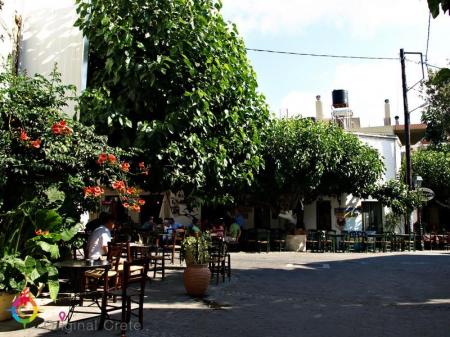
Anogeia of Milopotamos is a mountain town with important history and three holocausts. Anogeia preserves the Cretan tradition in the modern Crete. Anogeia is the…

The mountain and picturesque village of Apostoloi is about 30 kilometers from Rethimno. It falls under the Amari municipality of the Rethimno prefecture and the…

The imposing Kourtaliotiko gorge starts from the Koksare village of the Rethimno prefecture, about 22 kilometers from Rethimno and ends to the amazing beach of…

The picturesque settlement of the Agios Vasileios municipality in the Rethimno prefecture, Sachtouria, is in a very beautiful area, in the north-western side of…

Location 18 km from Heraklion Museums Argyraion War Ethnological Museum Sights G. Panagiotakis Municipal Park Venetian Monuments The Tower and…

Location Gerokambos Vaulted tombs Dating from the Late Minoan period Findings in the tombs Pottery, jewelry, tools that reflect burial customs and…

Location Αbout 75 km from Heraklion city Beach Quiet, unexplored, with sand and pebbles Facilities Limited, with taverns and a few accommodations…

Location 15 km from Heraklion on the national road to Chania Historical Significance Venetian fortress built in 1573 to protect the Gulf of Heraklion…

Location 3 km from the village of Fodele, 26 km from Heraklion Beach Sandy with crystal-clear turquoise waters and Blue Flag Amenities Western part…

Location: 27 km southeast of Heraklion Archaeological interest Acropolis of Smari, ancient settlement, significant finds Natural beauty Picturesque alleys,…

Location 16 km from Lentas Gorge Length Approximately 8 km, starting narrow and widening near the sea Access Dirt road connecting Trypiti with Loutra,…

Location 45 km south of Heraklion, next to the settlement of Agioi Deka Sights Roman Odeon, Great Inscription, Church of the Virgin Mary, Roman sculptures,…

Location 23 km northwest of Heraklion Residents Around 120 people History Mentioned in Venetian censuses as the fief of the Modinos brothers…

Location 55 km south of Heraklion Altitude 440 meters, offering beautiful countryside views Population 111 residents (according to the latest census)…

Location 18 km west of Heraklion, at an altitude of 440 meters History Founded by Venetians, it retains many architectural features from that period Residents 50…

Location Starts from Ano Archanes and ends near Knossos, Crete Length Approximately 6 km Main Points Sylamiano Gorge (accessible by car), Kato Mylos,…

Location 30 km southeast of Heraklion Altitude 340 meters Population Around 1500 Τourism metropolitan center of pottery in Crete History …

Location Located in the municipality of Archanes-Asterousia, 45 km from Heraklion Altitude 320 meters Residents Approximately 37 History The…

Location50 km southeast of Heraklion, in the municipality of Minoa Pediada Altitude Approximately 250 meters Residents Around 300 Historical landmarks Five…

Location 10 km east of Ano Viannos Elevation 2,141 meters Inhabitants Approximately 317 History First mentioned in 1583 by Kastrofylakas Churches Churches…

Location 50 km from Heraklion and 15 km from Ano Viannos Elevation 430 meters Inhabitants Approximately 430 History Mentioned r in documents…

Location 35 km from Heraklion, in the municipality of Minoa Pediada Elevation Built on a hill near the Avliotiko River Inhabitants Approximately…

Location: Viannos Municipality, southern slopes of Mount Dikti Altitude: 680m Population: 850 (Amiras and Arvi) Occupations: Agriculture, early vegetable cultivation…

Location near Kato Archanes Activities Hiking, mountain biking Archaeological Significance Largest prehistoric cemetery in the Aegean (2400 B.C.…

Location 80 km from Heraklion, secluded beach with towering cliffs and emerald waters Attractions Chapel of St. Anthony, with a well of drinking water,…

Location 23 km from Heraklion Altitude 380m Attractions Double-aisled church dedicated to the Dormition of the Virgin Mary and Saint Minas History One…

Location Located approximately 60 km south of Heraklion Population The settlement is divided into Tsoutsouros and Pera Tsoutsouros, with the population significantly…

Location 20 km west of Heraklion, 2 km from Agia Pelagia Beach Turquoise waters, coarse sand, sheltered from winds Facilities Sunbeds, umbrellas,…

Location 22km northwest of Heraklion, near Agia Pelagia Beach Type Pebbly beach, crystal-clear waters, sheltered from winds Facilities Sunbeds, umbrellas,…

Fodele, a picturesque village on Crete’s northern coast, is located 25 km west of Heraklion, along the national road to Chania. The village is set in a lush green…

Location Rodia, Municipality of Malevizi Era First half of the 15th century Architecture A three-story Venetian structure with storage and luxury…

Location Southwest of Heraklion Distance Ano and Kato Kalesia are about 300 meters apart Population Ano Kalesia ~300 residents, Kato Kalesia ~600…

Location Near Rogdia, 20 km from Heraklion History Founded during the Venetian period, a possible refuge for monks from coastal monasteries Architectural…

Location 20 km west of Heraklion Nature and landscape Lush vegetation, beaches with crystal-clear waters Beaches Main beach, Filakes, Kladissos,…

Location 64 km from Heraklion Attractions Picturesque chapels such as Saint Theodore, Saint Fanourios, Saint Nicholas, and Portela Gorge Population Approximately…

Location 90 km from Heraklion, 25 km from Ierapetra Population Approximately 70 residents, primarily engaged in agriculture Beach Coarse sand, unorganized,…

Location 70 km southeast of Heraklion Beach 7 km long, with coarse pebbles and golden sand Gorges Portela Gorge History Ruins of the ancient city of Keraia…

Location 74 km from Heraklion, 30 km from Ierapetra. Natural environment A lush valley with rich vegetation and fruit-bearing trees Natural attractions Blavopotamos…

Location 70 km southeast of Heraklion Facilities Taverns, cafes, rental rooms Harbor Small harbor serving local fishermen Beaches Western small…

Location 45 km southeast of Heraklion. Population Approximately 175 residents Archaeological Interest The ancient city of Arcadia (Arkades) was located…

Location The gorge is located in Arvion Mountain, near the village of Arvi Waterfall The Kapnisti waterfall has a height of approximately 80 meters Access Ideal…

Every part of the capital of Crete, Heraclion, shows a different culture, every culture that flourished in there during the centuries. Every area travels you to…

Just a few kilometers north of Heraklion, only 8 km from the city center, lies the picturesque area of Agia Irini, a green haven of peace, perfect for a quick escape…

Location Tymbaki, 63 km southwest of Heraklion History Inhabited from the Neolithic period to the Minoan palaces era Palaces The first palace was built in…

Location 60 km south of Heraklion, near Zaros Altitude 380 meters Attractions Church of the Dormition of the Virgin Mary History Recorded since…

Location 67 km from Heraklion and 2.5 km from Tympaki Beaches Two beaches: Katalyki (organized, sandy) and a western, unorganized beach (rocky and pebbly)…

Location 67 km south of Heraklion Beach The largest beach in southern Crete (2.5 km) with coarse sand and a rocky seabed Activities Ideal for water…

Location 60 km on the Heraklion-Tympaki road Altitude 80 m. Central Church A three-aisled church dedicated to the Nativity, Annunciation, and Dormition…

Location Mountainous village of the Gortyna Municipality, 35 km south of Heraklion Αltitude 640 meters History First mentioned in 1248, with significant…

Location 20 km from Heraklion Building Housed in an old mansion in Houdetsi’s village square Founder and Artistic Director Ross Daly, artistic…
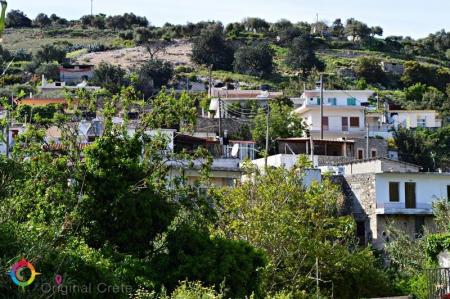
Location 23 km from Heraklion Αltitude of 440 m. Population Approximately 863 residents Main occupations Agriculture, tourism, trade, and technical…

The Treis Ekklisies (i.e. three churches) coastal settlement is behind the imposing Asterousia Mountains in the end of the Ampas gorge. It is an area that makes…

The impressive Ampa gorge is near Pananimfoi, in the Arxanes-Asterousia Municipality. Ampas is known to the locals for its natural beauty that includes also the…
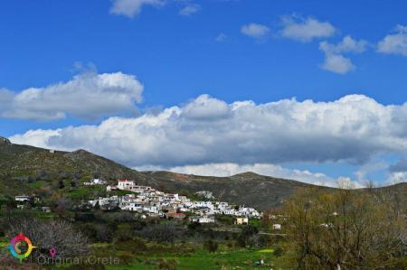
Paranimfoi is a picturesque, mountainous village in the east of Kofinas, with magnificent view to the Libyan Sea. Administratively the settlement is under the Archanes-Asterousia…

The picturesque Panagia Spiliotissa monastery is between Agios Vasileios and Choudetsi and 22 kilometers from Heraclion. In order to reach the monastery, you have…

Agioi Deka is one of the most important villages in Mesara archaeologically and the ruins of the ancient city of Gortyna are there. The settlement is built on the…

The archaeological site of the ancient city of Gortys or Gortina is 45 kilometers in the south of Heraclion, in the west side of the Agioi Deka settlement. The…

The path in the Agios Charalampos gorge is a part of the E4 European long distance route. Following the route, you can go through the impressive Agios Antonios…

The Kerasia settlement is built on the eastern sides of the Chalepa hill, 340 meters above the sea level, on the 20th kilometer of the national Heraclion-Mesara…

The Paliani Monastery is near and under Venerato of the Heraclion municipality and is one of the oldest monasteries in Crete. The female monastery is from the First…

The beautiful and traditional buildings and the two flour-mills in Kazola are worth visiting in Pirgou. Pirgou is 20 kilometers from Heraclion where, administratively,…

“… on the lap of the mountain and hidden from the sun is the large village of Petrokefalo” wrote N. Kazantzakis, in his book, “Kapetan Michalis”. Petrokefalo is…

The Monastery of Agios Georgios Gorgoleimon is on the foot of the Koudouni Mountain, 500 meters above the sea level, near the Kato Asites settlement. The monastery…

Ano Asites is a settlement of the former Malevizi district of the Heraclion municipality. It is a village of a high environmental, cultural and archaeological interest.…

The Agios Mironas settlement is exquisite for its architecture and its cultural activities. Administratively, the village is under the former Malevizi district,…

Tilisos is built on the ruins of the ancient city of Tilisos and is in the eastern foot of Psiloreitis. The name of the settlement has been used for over 3.400…

The small, picturesque settlement of Moni is about 17 kilometers from Heraclion, on the 1st kilometer of the Tilisos-Anogeia road. Moni is a village of the Malevizi…

The mountainous Marathos village of the Malevizi municipality is about 20 kilometers from Heraclion and 300 meters above the sea level. The Marathianos River is…

The mountain village of Damasta is about 27 kilometers from Heraclion and under the Malevizi municipality. Damasta is built on the northern sides of the Koiti hill,…

Pompia is one of the most beautiful and important villages in the Festos municipality. It is in an area full of olive groves and vineyards, next to the imposing…

The village of hippies, Matala, is approximately 70 kilometers in the south of Heraclion and is one of the most famous coastal settlements of the southern Crete.…

The small village of Magarikari is on the western foot of Psiloreitis. Magarikari is built 450 meters above the sea level and, from there, you can admire the Kato…

The path from the Kamares settlement ends to the large and impressive Kamares cavern. The visitor walks between a dense forest of oaks. The total time to the end…

Many beautiful and clean beaches are in Kaloi Limenes. Kaloi Limenes is 77 kilometers from Heraclion and it can be accessed by the asphalted road that goes through…

The beautiful male monastery of Odigitria is in the western end of the Asterousia Mountains, 250 meters above the sea level, near Agiofarago and Martsalo. The area…

The male monastery of Vrontisi is in the southern foot of Psiloreitis, between the villages of Zaros and Vorizia, 550 meters above the sea level. Administratively…

The monastery of Varsamoneri is one of the oldest monasteries in Crete, as it is from the first years of the Venetian occupation. The temple (with 3 aisles) dedicated…

The small temple of Agios Nikolaos from the 14th century is only preserved today from the important Zaros monastery. The church is 900 meters from the southern…

A very traditional and of high cultural importance village, Voroi, is 2-3 kilometers from Festos in the fertile plain of Mesara. Administratively Voroi falls under…

Stavies, in the Gortyna municipality, is a settlement where many interesting cultural events are taken place in the summer. Stavies is 60 kilometers from Heraclion…

A rock appears between olive trees in the Sokara area and some wine presses and rooms are carved on it. They were used as safe-keeping places and this is the archaeological…

The picturesque village of Sokaras is 50 kilometers from Heraclion between olive trees and fertile vineyards and garden produce of the plain of Mesara. Places of…

The ruins of the ancient city of Rizinia are on the Patella hill, 2 kilometers from Prinias. The city flourished as an independent community from the Sub-Minoan…

Prinias is a village of a high archaeological importance in Crete and one of the most beautiful settlements of the prefecture of Heraclion. It is 25 kilometers…

Platanos of the Kainourio district and the Gortyna municipality is 51 kilometers from Heraclion, 100 meters from Mesara plain. Two tombs have been excavated from…

Panasos is a small, picturesque village of Gortyna municipality. It is 35 kilometers from Heraclion and 450 meters above the sea level. The beautiful settlement…

Megali Vrisi is about 30 kilometers from Heraclion, in the north side of the basin of the Monafatsi district. The settlement is built amphitheatrically, 620 meters…

The small settlement of Koumasa is famous for the imposing gorge of Agios Savvas that starts from the southern side of the village and it is 4 kilometers long.…

“In Kapetaniana, whoever believes in God, he talks to Him”, Thanos Mikroutsikos. A heaven on Earth is in the holly hill of Kofina and stares the Libyan sea. Kapetaniana…
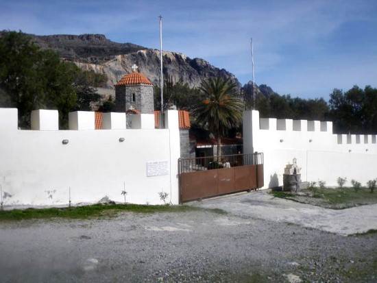
A magnificent path starts from the picturesque, mountainous village of Paranimfi and ends in the monastery of Koudoumas. The hiking takes many hours but the exploration…

The monastery of Koudoumas is very well protected by the imposing Asterousia Mountains, in the south of the cape of Martelos, and by the Libyan sea in the south.…

The Local and Natural History Museum of Gergeri was found in 1996 to record, study and make the characteristics of the natural environment known. Another reason…

The two lakes of the area are about 1 kilometer from Gergeri on a hill with a wonderful view. The one is a man-made water reservoir lake and the other a small,…

Gergeri is a large village in the southern foot of Psiloreitis and is built between impressive and steep cliffs. The wonderful forest of Rouvas is above the village.…

On the foot of the Asterousia mountains, from where the Xilvestra torrent of the Geropotamos tributary is, the village of the Gortyna municipality, Vagionia…

Asimi is in the Gortyna municipality and a modern town that serves the commercial, banking and other needs of the residents of the area. It is on the watershed…

Agios Thomas is a place with an imposing landscape, dense vegetation and a magnificent view. The carved winepresses, the Roman tombs, the Melissa fortress, the…

Agia Varvara, of the Gortyna municipality, is the longest village in Crete. The village is built along the road of Heraclion to western Mesara. The distance between…

Tefeli is about 12 kilometers from Pirgos and, administratively, it comes under the Archanes- Asterousia municipality. Aposelemi and Pirathi fall under the local…

Pretoria is a beautiful traditional village with paved alleys and yards full of many different flowers. The village is in the rich plain of Mesara between olive…

Peza of the Archanes- Asterousia municipality is famous for their agricultural tradition. Peza is built between many vineyards and olive trees, is 17 kilometers…

The museum of one of the most important modern writers is in Mirtia, 20 kilometers from Heraclion. Nikos Kazantzakis is recognized as the writer with the most translated…

“ The family of my father comes from a village two hours from Megalo Kastro and is called Varvari “ Nikos Kazantzakis wrote in his book “Anafora ston Greko” and…

The picturesque village of Metaxochori is built in the foot of a hill, 420 meters above the sea and 34 metres from Heraclion. The village belongs to the Archanes-Asterousia…
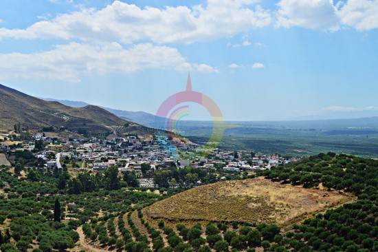
The large village of Mesochorio is in the foot of the Asphentilias hummock in the Asterousia mountains. The settlement is about 55 kilometers from Heraclion. The…

The fortress Castello di Beto stands as a guard on the top of the Kastellos hillock, east of the Melesses settlement. The ruins of the medieval fortress are preserved…

The coastal settlement of Maridaki is about 65 kilometers from Heraclion, behind the Asterousia Mountains. The small village is built at the end of the imposing…

Ligortinos is a traditional village which is built 380 meters above the sea level. The beautiful view with the tiled alleys and the magnificent monuments, like…

Kounavoi, the traditional village of Archanes-Asterousia Municipality, is where the Minoan city of Eltinia was. The settlement dominates in a small plain in the…

The picturesque village is on the top of a hillock next to the Anapodaris river and 240 meters above the sea level. Administratively it falls under the Archanes-…

The male monastery of Agios Georgios Epanosifis is one of the most important monasteries in Crete for its spiritual and social offer. The monastery is 30 kilometers…

The beautiful and lonely beach of Agios Nikitas is behind the Asterousia mountains in the bosom of the southern Cretan sea. In order to visit the beach, you should…

The monastery of Agios Nikitas is about 65 kilometers in the south of Heraclion behind the the imposing Asterousia mountains. Administratively, the monastery falls…
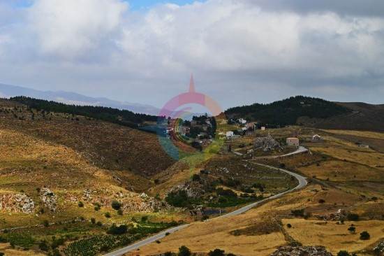
One of the most beautiful and traditional Cretan villages of Crete is Ethia in the Archanes-Asterousia Municipality. The village is about 55 kilometers from Heraclion,…

The lake of Damania is near the Damania settlement, in Archanes-Asterousia municipality and the prefecture of Heraclion. The dam gives the landscape an extra touch…

The small settlement of Damania is about 35 kilometers from Heraclion, built in the Southeastern sides of Ofis hummock and 420 meters above the sea level in the…

The beautiful gorge of Achentrias crosses the Asterousia mountains and reaches the Cretan sea. The Achentrias gorge starts from the settlement of Achentrias and…

In Achentrias the visitor can admire the many caverns of the Asterousia mountains. The most typical examples are the Archontospilios cave, in Agios Nikitas, and…

In the Achentrias settlement, in the Archanes-Asterousia municipality of the prefecture of Heraclion, there are many hiking options. You can either wander in the…
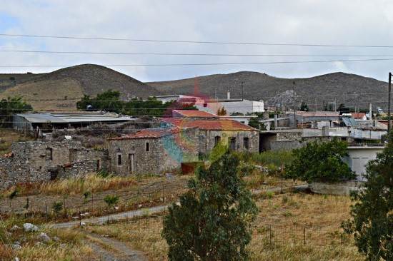
The picturesque mountainous village of Achentrias is 60 kilometers from Heraclion and 680 meters above the sea level. Administratively, it falls under the Archanes-Asterousia…

In Kato Vrisi, in Astritsi, someone can find a forgotten part of the paradise. Administratively, Astritsi belongs to the Archanes- Asterousia Municipality,…

Astraki is famous for its beautiful gorge that goes by the same name and it starts from there and also for the old Turkish quarter. The village is from the 12th…

The Tholi fortress was built in the last Venetian period, between 16th and 17th century. The Venetian fortress is in the west of the settlement of Alagni, on the…

Alagni is a village in the Archanes- Asterousia Municipality and is closely connected to mythology, history and tradition. Alagni is 25 kilometers from Heraclion,…

Agies Paraskies is built on a 360-meter hummock with a magnificent view. It is 20 kilometers in the south east of Heraclion and, administratively belongs to the…

Location 47 km from Heraklion Altitude Around 600 m Natural Highlights 1,800-2,000-year-old plane tree, Azilakodasos and Chamoprina forests History References from…

Location Situated at the eastern edge of the Ziros Plateau, 31 km from Sitia Settlements Includes Agia Irini, Agrilia, Kalo Chorio, Lamnoni, Xerokampos,…

Location Northeastern Lasithi, 70 km from Agios Nikolaos Beaches Sitia's main beach, Blue Flag-awarded, 2.5 km long, with organized facilities and water…

Location 18 km east of Ierapetra Hiking Route Approximately 20-minute hike on a moderate trail, accessible from the village of Agios Ioannis (elevation…

Location 12 km from Agios Nikolaos, 3 km from Neapolis Population 174 residents (2011) History Inhabited since the Late Minoan era, an important…

Location 9 km east of Makry Gialos Church Two-aisled cave church dedicated to Saint John the Baptist and the Holy Trinity Buildings Monks' cells,…

Location 12 km from Ierapetra, 45 km from Agios Nikolaos Beach Fine pebbles, crystal-clear waters, Blue Flag awarded Natural Beauty Surrounded by…

Location Northeast of the village of Milatos Archaeological Importance The cave has been in use since the Neolithic period Structure The cave consists…

Location 70 km from Heraklion Altitude 900 meters History Inhabited since the Neolithic era, it remained uninhabited during the Venetian era due…

The Toplou Monastery, one of the largest and most important monasteries in Crete, is in the Kavo Sidero Cape, 10 kilometers in the east of Sitia and 6 kilometers…

The impressive cavern of Pelekita or “tis Sikias o Spilios” is one of the biggest caverns in Crete and of a high archaeological importance. It is about 5 kilometers…

The gorge of Nekroi in Zakros is a very beautiful and important archaeologically gorge. Its name (“nekroi” means the dead, in Greek) came from the large number…

The Minoan Palace of Zakros is the fourth largest ancient palace in Crete after those of Knosos, Festos and Malia. It is 500 meters from Kato Zakros, 8 kilometers…

Zakros is one of the most picturesque villages of Crete that combines the natural beauty with the alternative activities and the important archaeological sites.…

Mirtos is a picturesque and tourist coastal settlement of the Lasithi prefecture. It is built near the banks of the Krios River, close to the exit of the imposing…

The ancient Lato city was about 3 kilometers in the north of Kritsa of the Agios Nikolaos municipality, in Lasithi. It was protected due to its geographical position…

The awarded city for its wonderful beaches, Ierapetra, is the unique city in the southern Crete and the last city in the southern end of Europe. Ierapetra is about…

The island of the tears and the island of the leppers are some of the characterizations of the beautiful and historical Spinaloga. Spinaloga is in the north of…

The picturesque and beautiful Kritsa village with important archaeological findings is in the Agios Nikolaos municipality of the Lasithi prefecture. The village…

The amazing and magnificent Elounta is known for the powerful and famous people from all over the world that visit it. Its beaches, its clean, blue sea, and the…

Agios NIkolaos, the beautiful capital of the Lasithi prefecture, is in the west side of the Meramvelo peninsula. The Voulismeni Lake in the center of the city is…