


Hugging Psiloreitis
Searching for water, the source of life, we follow the route that connects Psiloreitis with the green valley of Mesara. We start from Gergeri and, especially,...
184 results found
Searching for water, the source of life, we follow the route that connects Psiloreitis with the green valley of Mesara. We start from Gergeri and, especially,...

From ancient Gortyna to the picturesque village of Sivas, from Sivas to the historic and beautiful monastery Odigitrias and from the monastery Odigitrias to...

Do only lichnarakia, anevata (i.e. traditional sweets with mizithra), Easter eggs and roasted lamb or antikristo (i.e. lamb cooked opposite the fire) define Easter…

The weddings in Crete are a very important event not only for the couple and their parents but also for the whole community. All the people take part in the joy…

Location Aradena Gorge is located in Sfakia, Crete, and extends from the abandoned village of Aradena to the sea Length The gorge stretches over approximately…

The fortress of Gramvousa is on a steep hill of the Imeri Gramvousa Island, opposite the famous Mpalos beach. The building of the fortress started in 1584 by the…

Location 72 km southwest of Chania, overlooking the Libyan Sea Architecture A dazzling white monastery with fortress-like architecture perched on a 35-meter…

Location On Fortetsa Hill, south of Paleochora, Chania Construction Built in 1279 by the Venetians to control the surrounding region and the sea route…

The twelfth route of the E4 European Long DIstance Path in Crete is 20 kilometers long and lasts about 8 to 10 hours. You can follow it from May to September, it…

Location 58 km south of Chania Natural Environment Exit of the Samaria Gorge Access By hiking or sea transport Beaches Main beach split…

Location 42 km south of Chania city Length 18 kilometers, with a hiking duration of 4-8 hours National Park Declared in 1962, part of the UNESCO…

Location 75 km southeast of Chania History Unsubdued by conquerors from the Arab period through the Turkish occupation Activities Hiking on the E4…

The tenth route of the E4 European long distance Path is about 18 kilometers and lasts 6 hours and 30 minutes. The time it has to be followed is from May to October(due…

The ninth route of E4 European Long Distance Path is 13,5 kilometers and takes 7 hours and 30 minutes to follow it. The best season of the time to follow it is…

The eighth route of the E4 European Long Distance Path is about 24,5 kilometers and lasts 8 hours. It is better to follow it in spring or autumn, it is not a difficult…

The seventh route of the E4 European Long Distance Path is 19,5 kilometers long and lasts 5 hours and 30 minutes, You can follow it during the whole year, it has…

The sixth route of the E4 European long distance path is about 13 kilometers and lasts 3 hours and 30 minutes. The best time to take it is the whole year and, especially…

The fifth route of the E4 European Long Distance Path in Crete is 20 kilometers long and lasts 8 to 9 hours. You should follow it from April to September and the…

The third route of the E4 European long distance path is about 22 kilometers and lasts 5 hours. Its best visiting time of the year is spring, summer and autumn.…

Location 54 km from Heraklion Population Approximately 180 residents Settlements Pera Martha (Evangelismos) and Pode Martha (Saint John the Theologian)…

Location 8 km south of Rethymno Trail About 1.5 hours of easy hiking through lush greenery Natural features Rich vegetation with plane trees, fig…

12km south of Anogia, at altitude of 1200m, you can find the beautiful church of the orthodox saint of Agios Yakinthos. The church is located in the middle of a…

Location 40 km from the city of Rethymno, at the foothills of the Talaios mountains Population 305 residents (census) Attractions Turkish prisons,…

The Monastery of Arkadi combines the natural beauty with its important history and legends. It is about 23 kilometers from Rethimno, in a very green plateau, in…

Argyroupoli is one of the most beautiful villages of the Rethimno prefecture, on the hill between the springs of the Petre and Mousela Rivers after which the names…

Panormo is a traditional, coastal settlement of the Milopotamos municipality and the Rethimno prefecture. The picturesque village is about 22 kilometers from Rethimno…

Mpali in the Rethimno prefecture is one of the most beautiful tourist places of the northern beaches of Crete. The coastal settlement is 32 kilometers from Rethimno…
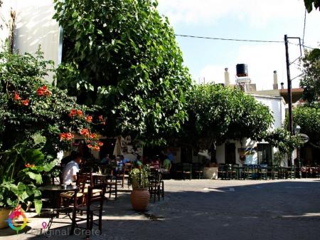
Anogeia of Milopotamos is a mountain town with important history and three holocausts. Anogeia preserves the Cretan tradition in the modern Crete. Anogeia is the…

The mountain and picturesque village of Apostoloi is about 30 kilometers from Rethimno. It falls under the Amari municipality of the Rethimno prefecture and the…

Spili is a traditional, mountain settlement of the Agios Vasileios municipality in the Rethimno prefecture. The settlement is built amphitheatrically, on the western…

Sellia is a village of the Agios Vasileios municipality and the Rethimno prefecture. Its local community is consisted of the settlements of Souda and Plakias. According…

Rodakino is one of the largest villages of the southern Rethimno prefecture. The village is on the foot of the Krioneritis Mountain, above the Rodakino beaches.…

The imposing Kourtaliotiko gorge starts from the Koksare village of the Rethimno prefecture, about 22 kilometers from Rethimno and ends to the amazing beach of…

Agia Galini is a very picturesque coastal settlement, 60 kilometers from Rethimno and about 70 kilometers from Heraclion. It “hangs” over the beautiful small port…

Location 18 km from Heraklion Museums Argyraion War Ethnological Museum Sights G. Panagiotakis Municipal Park Venetian Monuments The Tower and…

Location 15 km from Heraklion on the national road to Chania Historical Significance Venetian fortress built in 1573 to protect the Gulf of Heraklion…

Location: 27 km southeast of Heraklion Archaeological interest Acropolis of Smari, ancient settlement, significant finds Natural beauty Picturesque alleys,…

Location 75 km from Heraklion, 13 km from Lentas Access Dirt road from Krotos village, 4 km to the hill, 10-minute walk to the church Tradition Miraculous…

Location 45 km south of Heraklion, next to the settlement of Agioi Deka Sights Roman Odeon, Great Inscription, Church of the Virgin Mary, Roman sculptures,…

Location 23 km northwest of Heraklion Residents Around 120 people History Mentioned in Venetian censuses as the fief of the Modinos brothers…

Location 50 km south of Heraklion, at the foot of the Asterousia Mountains Population 1,000 residents (2011 census) Landmark The "Charaki" rock with…

Location 55 km south of Heraklion Altitude 440 meters, offering beautiful countryside views Population 111 residents (according to the latest census)…

Location 18 km west of Heraklion, at an altitude of 440 meters History Founded by Venetians, it retains many architectural features from that period Residents 50…

Location Starts from Ano Archanes and ends near Knossos, Crete Length Approximately 6 km Main Points Sylamiano Gorge (accessible by car), Kato Mylos,…

Location Located in the Minoa Pediada municipality, 30 km from Heraklion Altitude 330 meters Population Around 600 Religious tourism Known for…

Location 30 km southeast of Heraklion Altitude 340 meters Population Around 1500 Τourism metropolitan center of pottery in Crete History …

The female monastery of Agia Marina is 500 meters from the Voni village, in a large valley of many vineyards. A large number of people visits the monastery every…

Location Located in the municipality of Archanes-Asterousia, 45 km from Heraklion Altitude 320 meters Residents Approximately 37 History The…

Location50 km southeast of Heraklion, in the municipality of Minoa Pediada Altitude Approximately 250 meters Residents Around 300 Historical landmarks Five…

Location on Mount Dikti, 53 km from Heraklion Elevation 1,188 meters Inhabitants Around 230 Natural Environment The village is the endpoint…

Location 10 km east of Ano Viannos Elevation 2,141 meters Inhabitants Approximately 317 History First mentioned in 1583 by Kastrofylakas Churches Churches…

Location 50 km from Heraklion and 15 km from Ano Viannos Elevation 430 meters Inhabitants Approximately 430 History Mentioned r in documents…

Location 35 km from Heraklion, in the municipality of Minoa Pediada Elevation Built on a hill near the Avliotiko River Inhabitants Approximately…

Location: Viannos Municipality, southern slopes of Mount Dikti Altitude: 680m Population: 850 (Amiras and Arvi) Occupations: Agriculture, early vegetable cultivation…

Location 38 km from Ierapetra Altitude 560 m Attractions Agia Moni Monastery, churches of Agia Pelagia, Agios Georgios Population 900…

Location 15 km from Heraklion Altitude 360 m. Activities Hiking on the E4 trail, visit to the Museum of Cretan History Sights Archaeological site in Fourni, amazing…

Location 16 km from Heraklion Αltitude 380 meters Awards "Integrated Sustainable Settlement Development" Award (2000), Gold Environmental Award…

Location 53 km from Heraklion, on the southern slopes of Mount Psiloritis Attractions The Monastery of Varsamonero, dating back to the 18th century, is…

Location 23 km from Heraklion Altitude 380m Attractions Double-aisled church dedicated to the Dormition of the Virgin Mary and Saint Minas History One…

Location 25 km from Heraklion Exhibition Replicas of El Greco’s works, information about his life, family, and painting room Architectural Features: Housed…

Location Rodia, Municipality of Malevizi Era First half of the 15th century Architecture A three-story Venetian structure with storage and luxury…

Location 16 km northwest of Heraklion Population 1,326 residents, with 797 living in Rodia Venetian Mansion of Modinos A prime example of Venetian…

Location 8 km from Heraklion, a coastal village in the Malevizi municipality. Historical Significance Venetian fortress built on the acropolis of the…

Location Southwest of Heraklion Distance Ano and Kato Kalesia are about 300 meters apart Population Ano Kalesia ~300 residents, Kato Kalesia ~600…

Location Near Rogdia, 20 km from Heraklion History Founded during the Venetian period, a possible refuge for monks from coastal monasteries Architectural…

Location 90 kilometers southeast of Heraklion Beach Dark gray sand, clean and calm waters, organized with sunbeds and umbrellas Activities Water sports, beach…

Location 64 km from Heraklion Attractions Picturesque chapels such as Saint Theodore, Saint Fanourios, Saint Nicholas, and Portela Gorge Population Approximately…

Location 70 km southeast of Heraklion Beach 7 km long, with coarse pebbles and golden sand Gorges Portela Gorge History Ruins of the ancient city of Keraia…

Location 74 km from Heraklion, 30 km from Ierapetra. Natural environment A lush valley with rich vegetation and fruit-bearing trees Natural attractions Blavopotamos…

Location 70 km southeast of Heraklion Facilities Taverns, cafes, rental rooms Harbor Small harbor serving local fishermen Beaches Western small…

Location Exit of Arvi Gorge, 90 km from Heraklion History Built on the ruins of the temple of Arvios Zeus Religious significance Two churches dedicated…

Arvi is a coastal settlement of the Viannos municipality, 80 kilometers from Heraklion and 35 kilometers from Ierapetra. The settlement is in front of a valley…

Every part of the capital of Crete, Heraclion, shows a different culture, every culture that flourished in there during the centuries. Every area travels you to…

Location 65 km south of Heraklion Altitude 80 meters Attractions Traditional village with tourist facilities History Inhabited since 961 A.D.…

Location 60 km south of Heraklion, near Zaros Altitude 380 meters Attractions Church of the Dormition of the Virgin Mary History Recorded since…

Location 67 km from Heraklion and 2.5 km from Tympaki Beaches Two beaches: Katalyki (organized, sandy) and a western, unorganized beach (rocky and pebbly)…

Location 60 km on the Heraklion-Tympaki road Altitude 80 m. Central Church A three-aisled church dedicated to the Nativity, Annunciation, and Dormition…

Location Mountainous village of the Gortyna Municipality, 35 km south of Heraklion Αltitude 640 meters History First mentioned in 1248, with significant…
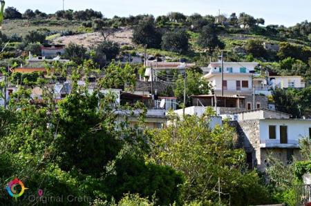
Location 23 km from Heraklion Αltitude of 440 m. Population Approximately 863 residents Main occupations Agriculture, tourism, trade, and technical…

The Treis Ekklisies (i.e. three churches) coastal settlement is behind the imposing Asterousia Mountains in the end of the Ampas gorge. It is an area that makes…
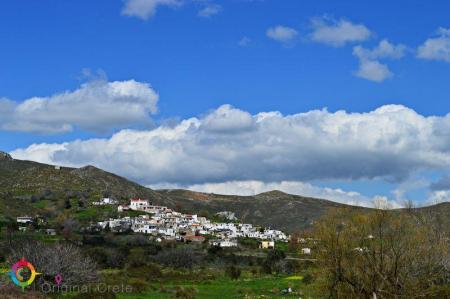
Paranimfoi is a picturesque, mountainous village in the east of Kofinas, with magnificent view to the Libyan Sea. Administratively the settlement is under the Archanes-Asterousia…

The picturesque Panagia Spiliotissa monastery is between Agios Vasileios and Choudetsi and 22 kilometers from Heraclion. In order to reach the monastery, you have…

Agioi Deka is one of the most important villages in Mesara archaeologically and the ruins of the ancient city of Gortyna are there. The settlement is built on the…

The archaeological site of the ancient city of Gortys or Gortina is 45 kilometers in the south of Heraclion, in the west side of the Agioi Deka settlement. The…

The path in the Agios Charalampos gorge is a part of the E4 European long distance route. Following the route, you can go through the impressive Agios Antonios…

The gorge of Venerato is a very small gorge, 500 meters long and with a natural beauty. The gorge is between Venerato and the Paliani Monastery and 17 kilometers…

Siva is a village of the Heraclion municipality, 280 meters above the sea level. 260 people live in the settlement and their main occupations are olive crop and…

The Paliani Monastery is near and under Venerato of the Heraclion municipality and is one of the oldest monasteries in Crete. The female monastery is from the First…

Avgeniki is a village of the Heraclion municipality, on the 20th kilometer of the Heraclion-Timpaki road. The entrance of the Venerato gorge is near the settlement…

The beautiful and traditional buildings and the two flour-mills in Kazola are worth visiting in Pirgou. Pirgou is 20 kilometers from Heraclion where, administratively,…

“… on the lap of the mountain and hidden from the sun is the large village of Petrokefalo” wrote N. Kazantzakis, in his book, “Kapetan Michalis”. Petrokefalo is…

Pentamodi is a quiet and picturesque village in the valley of the Gazanos River, 17 kilometers from Heraclion. Administratively, the village is under the extended…

Kato Asites is a beautiful, mountain village on the foot of the Psiloreitis Mountain, 450 meters above the sea level. The distance of the village to Heraclion is…

The Monastery of Agios Georgios Gorgoleimon is on the foot of the Koudouni Mountain, 500 meters above the sea level, near the Kato Asites settlement. The monastery…

The gorge starts from the small Agios Charalampos church in the south of the Ano Asites settlement. The small gorge is easily accessed, particularly in the summer,…

Ano Asites is a settlement of the former Malevizi district of the Heraclion municipality. It is a village of a high environmental, cultural and archaeological interest.…

The Agios Mironas settlement is exquisite for its architecture and its cultural activities. Administratively, the village is under the former Malevizi district,…

Tilisos is built on the ruins of the ancient city of Tilisos and is in the eastern foot of Psiloreitis. The name of the settlement has been used for over 3.400…

The small, picturesque settlement of Moni is about 17 kilometers from Heraclion, on the 1st kilometer of the Tilisos-Anogeia road. Moni is a village of the Malevizi…

The mountainous Marathos village of the Malevizi municipality is about 20 kilometers from Heraclion and 300 meters above the sea level. The Marathianos River is…

Faneromeni is a village of the Festos municipality and 4 kilometers from Timpaki. The Faneromeni local community also includes Kalivia and the Kaliviani monastery.…

Skourvoula of the Festos municipality is built on the southern foot of Sanidas Mountain, 350 meters above the sea level, with a panoramic view of the fertile Mesara…
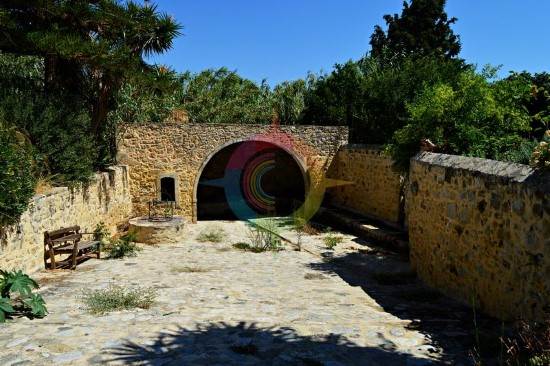
Sivas is one of the most beautiful villages in the Festos municipality, in the south-west side of Mesara plain. The settlement is built 110 meters above the sea…

Pompia is one of the most beautiful and important villages in the Festos municipality. It is in an area full of olive groves and vineyards, next to the imposing…

Platia Peramata is a small settlement in the middle of the dirt road that connects Kaloi Limenes with Lentas. The settlement is 70 kilometers from Heraklion. A…

Petrokefali of the Festos municipality is a beautiful village with recently renovated rock houses and 59 kilometers from Heraclion. There are many coffee houses…

Moires is the seat of the Festos municipality. It is a large town of the former Kainourio district, 53 kilometers from Heraklion and built in the Mesara plain,…

The small village of Magarikari is on the western foot of Psiloreitis. Magarikari is built 450 meters above the sea level and, from there, you can admire the Kato…

The two Towers of Kourmoulides are in Kouses of Festos municipality. The Towers belonged to the Kourmoulis family who were Crypto- Christians and helped Christians…

Kouses is a historical village of the former Kainourio district and of the Festos municipality. The village is on the northern foot of the Pirgos hummock of the…

Kastelli, in the former district of Kainourrgio, in the Festos municipality, is in the southern foot of Psiloreitis, very close to the fortress of Castel Nuovo.…
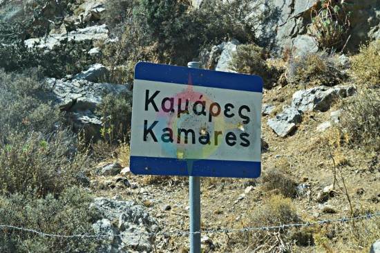
Kamares of the former Pirgiotissa district and of the Festos municipality is in the southern foot of Psiloreitis. 437 people live in the village according to the…

Chrisostomo is a small coastal settlement, approximately 75 kilometers from Heraclion and 2 kilometers in the east of Kaloi Limenes. According to findings, the…

Many beautiful and clean beaches are in Kaloi Limenes. Kaloi Limenes is 77 kilometers from Heraclion and it can be accessed by the asphalted road that goes through…

The beautiful male monastery of Odigitria is in the western end of the Asterousia Mountains, 250 meters above the sea level, near Agiofarago and Martsalo. The area…

The male monastery of Vrontisi is in the southern foot of Psiloreitis, between the villages of Zaros and Vorizia, 550 meters above the sea level. Administratively…

The small temple of Agios Nikolaos from the 14th century is only preserved today from the important Zaros monastery. The church is 900 meters from the southern…

The beautiful and interesting town of Zaros is built 45 kilometers from Heraclion and is included in the Festos municipality. It is in the southern foot of the…

A very traditional and of high cultural importance village, Voroi, is 2-3 kilometers from Festos in the fertile plain of Mesara. Administratively Voroi falls under…

Alithini is a small village in the former district of Kainourgio, in the Gortyna municipality. The settlement is 150 meters above the sea level. 150 people live…

Sternes is a village of the Gortyna municipality, 55 kilometers from Heraclion. The settlement is built on the northern foot of the Asterousia Mountain, 310 meters…

The Agios Savvas gorge is one of the most beautiful and imposing gorges of the Asterousia Mountains. Its length is 4 kilometers and, then, it is connected with…

Stavies, in the Gortyna municipality, is a settlement where many interesting cultural events are taken place in the summer. Stavies is 60 kilometers from Heraclion…

The picturesque village of Sokaras is 50 kilometers from Heraclion between olive trees and fertile vineyards and garden produce of the plain of Mesara. Places of…

Prinias is a village of a high archaeological importance in Crete and one of the most beautiful settlements of the prefecture of Heraclion. It is 25 kilometers…

Platanos of the Kainourio district and the Gortyna municipality is 51 kilometers from Heraclion, 100 meters from Mesara plain. Two tombs have been excavated from…

Panasos is a small, picturesque village of Gortyna municipality. It is 35 kilometers from Heraclion and 450 meters above the sea level. The beautiful settlement…

“I don’t believe that there is any village like Nivritos in a place full of flowers and near mountains”. The picturesque village is on the foot of the Ampelakia…

Megali Vrisi is about 30 kilometers from Heraclion, in the north side of the basin of the Monafatsi district. The settlement is built amphitheatrically, 620 meters…
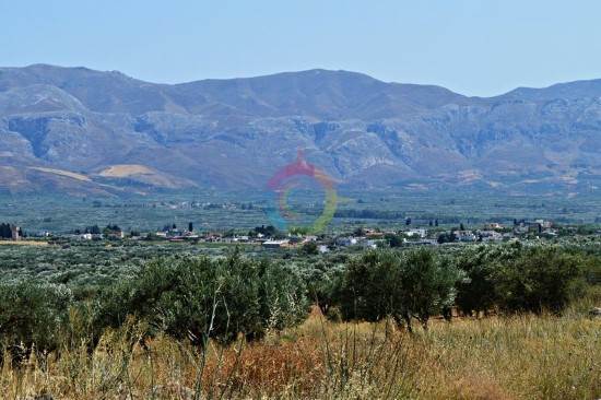
Loures, the village of the Gortyna municipality, is in the northern edge of the Mesara plain, 54 kilometers from Heraclion. Loures are 270 meters above the sea…

“In Kapetaniana, whoever believes in God, he talks to Him”, Thanos Mikroutsikos. A heaven on Earth is in the holly hill of Kofina and stares the Libyan sea. Kapetaniana…

The old monastery of Panagia Kardiotissa is in a magnificent and verdant area. Some kilometers before the village of Agios Thomas (coming from Heraclion), in the…
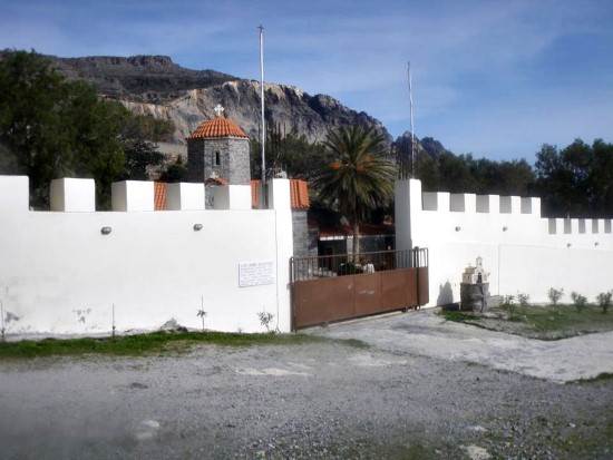
A magnificent path starts from the picturesque, mountainous village of Paranimfi and ends in the monastery of Koudoumas. The hiking takes many hours but the exploration…

The monastery of Koudoumas is very well protected by the imposing Asterousia Mountains, in the south of the cape of Martelos, and by the Libyan sea in the south.…

Dionisi is a small, picturesque village of the Gortyna municipality and 57 kilometers from Heraclion. The settlement is built on the northern foot of Asterousia…

Gergeri is a large village in the southern foot of Psiloreitis and is built between impressive and steep cliffs. The wonderful forest of Rouvas is above the village.…

The Vasiliki village is near the Asterousia Mountains, 260 meters above the sea level and 56 kilometers from Heraclion. The Vasiliki community includes Vasiliki…

On the foot of the Asterousia mountains, from where the Xilvestra torrent of the Geropotamos tributary is, the village of the Gortyna municipality, Vagionia…

Asimi is in the Gortyna municipality and a modern town that serves the commercial, banking and other needs of the residents of the area. It is on the watershed…

Ano Akria is a village of the Gortyna municipality. The settlement is 40 kilometers from Heraclion and built on the semi- mountainous area of the hummock of the…

The cave of Agios Antonios is in a lonely area at about the middle of the path that connects the settlement of Agios Ioannis with the monastery of Koudoumas. If…

The path which connects the monastery with the coastal settlement of Agios Ioannis is in the west of the monastery of Koudoumas. The route is easy and lasts about…
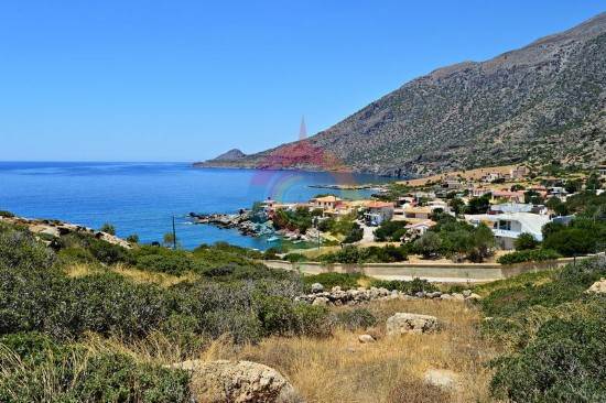
The settlement of Agios Ioannis is a few meters from Kapetaniana, after a winding, dirt road. It its built along the Ponta peninsula . A wonderful beach with blue…

The Melissa fortress in near the settlement of Agios Thomas, on the top of a hill with a magnificent view. It is one of the largest fortifications of the inland…

The most impressive tomb of Crete is in Agios Thomas, in Gria Mantra. The monolithic Roman tombs are preserved in a very good condition. The path in the south of…

Agios Thomas is a place with an imposing landscape, dense vegetation and a magnificent view. The carved winepresses, the Roman tombs, the Melissa fortress, the…

Agia Varvara, of the Gortyna municipality, is the longest village in Crete. The village is built along the road of Heraclion to western Mesara. The distance between…

Charaki is about 35 kilometers from Heraclion and 350 meters above the sea level. Administratively, the village is under the Archanes-Asterousia municipality and…

Tefeli is about 12 kilometers from Pirgos and, administratively, it comes under the Archanes- Asterousia municipality. Aposelemi and Pirathi fall under the local…

Peza of the Archanes- Asterousia municipality is famous for their agricultural tradition. Peza is built between many vineyards and olive trees, is 17 kilometers…

“ The family of my father comes from a village two hours from Megalo Kastro and is called Varvari “ Nikos Kazantzakis wrote in his book “Anafora ston Greko” and…

The picturesque village of Metaxochori is built in the foot of a hill, 420 meters above the sea and 34 metres from Heraclion. The village belongs to the Archanes-Asterousia…
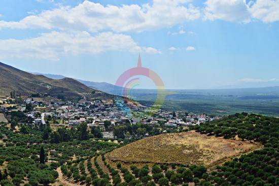
The large village of Mesochorio is in the foot of the Asphentilias hummock in the Asterousia mountains. The settlement is about 55 kilometers from Heraclion. The…

The fortress Castello di Beto stands as a guard on the top of the Kastellos hillock, east of the Melesses settlement. The ruins of the medieval fortress are preserved…

The beautiful village of Melesses in the Archanes-Asterousia municipality gives a colorful touch from the mediaeval pattern. Nature has given the most beautiful…

The coastal settlement of Maridaki is about 65 kilometers from Heraclion, behind the Asterousia Mountains. The small village is built at the end of the imposing…

Ligortinos is a traditional village which is built 380 meters above the sea level. The beautiful view with the tiled alleys and the magnificent monuments, like…

Kounavoi, the traditional village of Archanes-Asterousia Municipality, is where the Minoan city of Eltinia was. The settlement dominates in a small plain in the…

The picturesque village is on the top of a hillock next to the Anapodaris river and 240 meters above the sea level. Administratively it falls under the Archanes-…

The male monastery of Agios Georgios Epanosifis is one of the most important monasteries in Crete for its spiritual and social offer. The monastery is 30 kilometers…

The monastery of Agios Nikitas is about 65 kilometers in the south of Heraclion behind the the imposing Asterousia mountains. Administratively, the monastery falls…
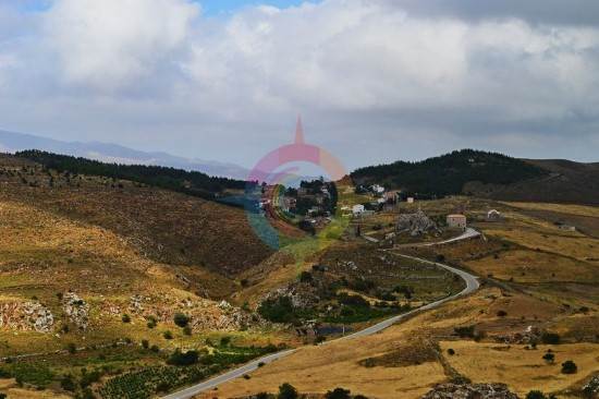
One of the most beautiful and traditional Cretan villages of Crete is Ethia in the Archanes-Asterousia Municipality. The village is about 55 kilometers from Heraclion,…

The lake of Damania is near the Damania settlement, in Archanes-Asterousia municipality and the prefecture of Heraclion. The dam gives the landscape an extra touch…

In the Achentrias settlement, in the Archanes-Asterousia municipality of the prefecture of Heraclion, there are many hiking options. You can either wander in the…
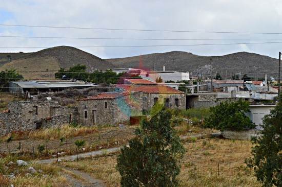
The picturesque mountainous village of Achentrias is 60 kilometers from Heraclion and 680 meters above the sea level. Administratively, it falls under the Archanes-Asterousia…

In Kato Vrisi, in Astritsi, someone can find a forgotten part of the paradise. Administratively, Astritsi belongs to the Archanes- Asterousia Municipality,…

The gorges of Astrakias, Kunavi and Karteros are parts of the wide geographical cluster from where the E4 European long distance path passes by. Its total length…

Astraki is famous for its beautiful gorge that goes by the same name and it starts from there and also for the old Turkish quarter. The village is from the 12th…

Alagni is a village in the Archanes- Asterousia Municipality and is closely connected to mythology, history and tradition. Alagni is 25 kilometers from Heraclion,…

Agies Paraskies is built on a 360-meter hummock with a magnificent view. It is 20 kilometers in the south east of Heraclion and, administratively belongs to the…

Location Situated at the eastern edge of the Ziros Plateau, 31 km from Sitia Settlements Includes Agia Irini, Agrilia, Kalo Chorio, Lamnoni, Xerokampos,…

Location 12 km from Agios Nikolaos, 3 km from Neapolis Population 174 residents (2011) History Inhabited since the Late Minoan era, an important…

Location 16 km from Agios Nikolaos Population 205 residents (2011 census) History Settled since 1400, the name comes from the Venetian word "Kastelium."…

Location 9 km east of Makry Gialos Church Two-aisled cave church dedicated to Saint John the Baptist and the Holy Trinity Buildings Monks' cells,…

The Preveli Monastery is about 35 kilometers in the south of Rethimno and the famous and beautiful palm forest is next to it. The monastery is in the west of the…

The Toplou Monastery, one of the largest and most important monasteries in Crete, is in the Kavo Sidero Cape, 10 kilometers in the east of Sitia and 6 kilometers…

Mirtos is a picturesque and tourist coastal settlement of the Lasithi prefecture. It is built near the banks of the Krios River, close to the exit of the imposing…

The awarded city for its wonderful beaches, Ierapetra, is the unique city in the southern Crete and the last city in the southern end of Europe. Ierapetra is about…

Agios NIkolaos, the beautiful capital of the Lasithi prefecture, is in the west side of the Meramvelo peninsula. The Voulismeni Lake in the center of the city is…


