


Hugging Psiloreitis
Searching for water, the source of life, we follow the route that connects Psiloreitis with the green valley of Mesara. We start from Gergeri and, especially,...
107 results found
Searching for water, the source of life, we follow the route that connects Psiloreitis with the green valley of Mesara. We start from Gergeri and, especially,...

Many people know its existence, its history and have visited it. It is Knossos, the house of Minoas. It is known to everyone living in Crete or visiting it....

The Natural History Museum works under the framework of the University of Crete and is on the Sofoklis Venizelos coastal Street. The exhibition of the museum is…

One of the most important museums of Greece, the Archaeological Museum of Heraklion, is in the north-east of the Eleftheria square. The building of the museum began…

The Historical Museum of Heraclion is in the coastal road, on the 27th of Sofoklis Venizelos Street. The Historical Museum of Heraclion was founded by the Society…

Every part of the capital of Crete, Heraclion, shows a different culture, every culture that flourished in there during the centuries. Every area travels you to…

Kapetanakeio is one of the historical buildings of Heraclion that dominates in one of the most beautiful spots of the city. The 1stGymnasium of Heraclion, theoldest…

Bougatsa is the sweet… custom of the New Year’s Day and Heraclion. Tones of bougatsa are consumed by the people of Heraclion in the night of the New Year’s Eve…

The Agiofarago climbing spot is in the Agiofarago gorge, in the south of the Heraclion prefecture, of Festos municipality. It is the southernmost climbing place…

Prostitutes, rebetes and mages were the residents of the Lakkos neighbourhood. In Lakos, there were weird feasts, hashish making and other illegal acts that could…

Location South of Sfakia, 75 km from Chania. Historical Interest Venetian castle and the legend of the Drosoulites. Beaches Main beach, Orthi Ammos,…

Location 75 km southeast of Chania History Unsubdued by conquerors from the Arab period through the Turkish occupation Activities Hiking on the E4…

Location 54 km from Heraklion Population Approximately 180 residents Settlements Pera Martha (Evangelismos) and Pode Martha (Saint John the Theologian)…

Location Rethymno, 25 km from Rethymno and 95 km from Heraklion Ecological Significance One of the most important wetlands in the southeastern Mediterranean…

Location 30 km from Heraklion Length 5 km, with an estimated walking time of 1 hour Trail Easy and accessible year-round, with dense vegetation and…

Location 18 km from Heraklion Museums Argyraion War Ethnological Museum Sights G. Panagiotakis Municipal Park Venetian Monuments The Tower and…

Location Αbout 75 km from Heraklion city Beach Quiet, unexplored, with sand and pebbles Facilities Limited, with taverns and a few accommodations…

Location 15 km from Heraklion on the national road to Chania Historical Significance Venetian fortress built in 1573 to protect the Gulf of Heraklion…

Location 3 km from the village of Fodele, 26 km from Heraklion Beach Sandy with crystal-clear turquoise waters and Blue Flag Amenities Western part…

Location 34 km from Heraklion Αltitude 340 meters History Discoveries of a Minoan settlement and the town’s name deriving from an ancient fortress…

Location: 27 km southeast of Heraklion Archaeological interest Acropolis of Smari, ancient settlement, significant finds Natural beauty Picturesque alleys,…

Location 16 km from Lentas Gorge Length Approximately 8 km, starting narrow and widening near the sea Access Dirt road connecting Trypiti with Loutra,…

Location 75 km from Heraklion, 13 km from Lentas Access Dirt road from Krotos village, 4 km to the hill, 10-minute walk to the church Tradition Miraculous…

Location 45 km south of Heraklion, next to the settlement of Agioi Deka Sights Roman Odeon, Great Inscription, Church of the Virgin Mary, Roman sculptures,…

Location 23 km northwest of Heraklion Residents Around 120 people History Mentioned in Venetian censuses as the fief of the Modinos brothers…

Location 50 km south of Heraklion, at the foot of the Asterousia Mountains Population 1,000 residents (2011 census) Landmark The "Charaki" rock with…

Location 55 km south of Heraklion Altitude 440 meters, offering beautiful countryside views Population 111 residents (according to the latest census)…

Location 18 km west of Heraklion, at an altitude of 440 meters History Founded by Venetians, it retains many architectural features from that period Residents 50…

Neraidospilios is 20km south of Heraklion, in the green gorge of Astraki. According to the legend, in the Fairy Cave of Astrakas located in the gorge of Karteros,…

Location Located in the Minoa Pediada municipality, 30 km from Heraklion Altitude 330 meters Population Around 600 Religious tourism Known for…

Location 30 km southeast of Heraklion Altitude 340 meters Population Around 1500 Τourism metropolitan center of pottery in Crete History …

The female monastery of Agia Marina is 500 meters from the Voni village, in a large valley of many vineyards. A large number of people visits the monastery every…

Location Located in the municipality of Archanes-Asterousia, 45 km from Heraklion Altitude 320 meters Residents Approximately 37 History The…

Location50 km southeast of Heraklion, in the municipality of Minoa Pediada Altitude Approximately 250 meters Residents Around 300 Historical landmarks Five…

Location on Mount Dikti, 53 km from Heraklion Elevation 1,188 meters Inhabitants Around 230 Natural Environment The village is the endpoint…

Location 10 km east of Ano Viannos Elevation 2,141 meters Inhabitants Approximately 317 History First mentioned in 1583 by Kastrofylakas Churches Churches…

Location 50 km from Heraklion and 15 km from Ano Viannos Elevation 430 meters Inhabitants Approximately 430 History Mentioned r in documents…

Location 35 km from Heraklion, in the municipality of Minoa Pediada Elevation Built on a hill near the Avliotiko River Inhabitants Approximately…

Location: Viannos Municipality, southern slopes of Mount Dikti Altitude: 680m Population: 850 (Amiras and Arvi) Occupations: Agriculture, early vegetable cultivation…

Location Between Tsoutsouros and Kastri, Southern Crete Beach Features Coarse sand, rocks, clean South Cretan Sea waters Facilities Unorganized beach…

The historical and folklore Museum of Viannos was found in 1996 and exhibits many important objects. Some agricultural tools are exhibited and the professions of…

Location 38 km from Ierapetra Altitude 560 m Attractions Agia Moni Monastery, churches of Agia Pelagia, Agios Georgios Population 900…

Location 15 km from Heraklion Altitude 360 m. Activities Hiking on the E4 trail, visit to the Museum of Cretan History Sights Archaeological site in Fourni, amazing…

Location near Kato Archanes Activities Hiking, mountain biking Archaeological Significance Largest prehistoric cemetery in the Aegean (2400 B.C.…

Location 16 km from Heraklion Αltitude 380 meters Awards "Integrated Sustainable Settlement Development" Award (2000), Gold Environmental Award…

Location 53 km from Heraklion, on the southern slopes of Mount Psiloritis Attractions The Monastery of Varsamonero, dating back to the 18th century, is…

Location 80 km from Heraklion, secluded beach with towering cliffs and emerald waters Attractions Chapel of St. Anthony, with a well of drinking water,…

Location 23 km from Heraklion Altitude 380m Attractions Double-aisled church dedicated to the Dormition of the Virgin Mary and Saint Minas History One…

Location Located approximately 60 km south of Heraklion Population The settlement is divided into Tsoutsouros and Pera Tsoutsouros, with the population significantly…

Location 25 km from Heraklion Exhibition Replicas of El Greco’s works, information about his life, family, and painting room Architectural Features: Housed…

Location 20 km west of Heraklion, 2 km from Agia Pelagia Beach Turquoise waters, coarse sand, sheltered from winds Facilities Sunbeds, umbrellas,…

Location 22km northwest of Heraklion, near Agia Pelagia Beach Type Pebbly beach, crystal-clear waters, sheltered from winds Facilities Sunbeds, umbrellas,…

Fodele, a picturesque village on Crete’s northern coast, is located 25 km west of Heraklion, along the national road to Chania. The village is set in a lush green…

Location Rodia, Municipality of Malevizi Era First half of the 15th century Architecture A three-story Venetian structure with storage and luxury…

Location 16 km northwest of Heraklion Population 1,326 residents, with 797 living in Rodia Venetian Mansion of Modinos A prime example of Venetian…

Location 14th km of the Heraklion – Rethymno National Road Small Port Picturesque harbor with traditional taverns offering fresh seafood Beach A…

Location 8 km from Heraklion, a coastal village in the Malevizi municipality. Historical Significance Venetian fortress built on the acropolis of the…

Location Southwest of Heraklion Distance Ano and Kato Kalesia are about 300 meters apart Population Ano Kalesia ~300 residents, Kato Kalesia ~600…

Location Near Rogdia, 20 km from Heraklion History Founded during the Venetian period, a possible refuge for monks from coastal monasteries Architectural…

Location 20 km west of Heraklion Nature and landscape Lush vegetation, beaches with crystal-clear waters Beaches Main beach, Filakes, Kladissos,…

Location 90 kilometers southeast of Heraklion Beach Dark gray sand, clean and calm waters, organized with sunbeds and umbrellas Activities Water sports, beach…

Location It starts from the village of Hondros, municipality of Viannos, and ends near Keratokampos Length 4.6 kilometers River The Keratokampitis…

Location 64 km from Heraklion Attractions Picturesque chapels such as Saint Theodore, Saint Fanourios, Saint Nicholas, and Portela Gorge Population Approximately…

Location 90 km from Heraklion, 25 km from Ierapetra Population Approximately 70 residents, primarily engaged in agriculture Beach Coarse sand, unorganized,…

Location 70 km southeast of Heraklion Beach 7 km long, with coarse pebbles and golden sand Gorges Portela Gorge History Ruins of the ancient city of Keraia…

Location 74 km from Heraklion, 30 km from Ierapetra. Natural environment A lush valley with rich vegetation and fruit-bearing trees Natural attractions Blavopotamos…

Location 70 km southeast of Heraklion Facilities Taverns, cafes, rental rooms Harbor Small harbor serving local fishermen Beaches Western small…

Location Exit of Arvi Gorge, 90 km from Heraklion History Built on the ruins of the temple of Arvios Zeus Religious significance Two churches dedicated…

Location 45 km southeast of Heraklion. Population Approximately 175 residents Archaeological Interest The ancient city of Arcadia (Arkades) was located…

Arvi is a coastal settlement of the Viannos municipality, 80 kilometers from Heraklion and 35 kilometers from Ierapetra. The settlement is in front of a valley…

Location On a hill near Heraklion, 12 km from the city Population Approximately 830 residents History Mentioned in Venetian records. Damaged by the…

Just a few kilometers north of Heraklion, only 8 km from the city center, lies the picturesque area of Agia Irini, a green haven of peace, perfect for a quick escape…

Location 5 km southeast of Heraklion Timeline Inhabited from the 7th millennium to Roman times Architecture Multi-story palace covering 22,000 sq.m.…

Location Tymbaki, 63 km southwest of Heraklion History Inhabited from the Neolithic period to the Minoan palaces era Palaces The first palace was built in…

Location 65 km south of Heraklion Altitude 80 meters Attractions Traditional village with tourist facilities History Inhabited since 961 A.D.…

Location 60 km south of Heraklion, near Zaros Altitude 380 meters Attractions Church of the Dormition of the Virgin Mary History Recorded since…

Location 67 km from Heraklion and 2.5 km from Tympaki Beaches Two beaches: Katalyki (organized, sandy) and a western, unorganized beach (rocky and pebbly)…

Location 67 km south of Heraklion Beach The largest beach in southern Crete (2.5 km) with coarse sand and a rocky seabed Activities Ideal for water…

Location 60 km on the Heraklion-Tympaki road Altitude 80 m. Central Church A three-aisled church dedicated to the Nativity, Annunciation, and Dormition…

Location Mountainous village of the Gortyna Municipality, 35 km south of Heraklion Αltitude 640 meters History First mentioned in 1248, with significant…

Location 20 km from Heraklion Building Housed in an old mansion in Houdetsi’s village square Founder and Artistic Director Ross Daly, artistic…
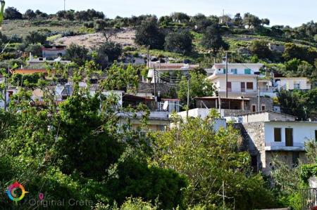
Location 23 km from Heraklion Αltitude of 440 m. Population Approximately 863 residents Main occupations Agriculture, tourism, trade, and technical…

The Treis Ekklisies (i.e. three churches) coastal settlement is behind the imposing Asterousia Mountains in the end of the Ampas gorge. It is an area that makes…

The path in the Agios Charalampos gorge is a part of the E4 European long distance route. Following the route, you can go through the impressive Agios Antonios…

The gorge of Venerato is a very small gorge, 500 meters long and with a natural beauty. The gorge is between Venerato and the Paliani Monastery and 17 kilometers…

Siva is a village of the Heraclion municipality, 280 meters above the sea level. 260 people live in the settlement and their main occupations are olive crop and…

The Kerasia settlement is built on the eastern sides of the Chalepa hill, 340 meters above the sea level, on the 20th kilometer of the national Heraclion-Mesara…

The Paliani Monastery is near and under Venerato of the Heraclion municipality and is one of the oldest monasteries in Crete. The female monastery is from the First…

Venerato is a village of the Heraclion municipality, 20 kilometers from the Heraclion city. Administratively the district is consisted of Venerato, the Paliani…

The beautiful and traditional buildings and the two flour-mills in Kazola are worth visiting in Pirgou. Pirgou is 20 kilometers from Heraclion where, administratively,…

“… on the lap of the mountain and hidden from the sun is the large village of Petrokefalo” wrote N. Kazantzakis, in his book, “Kapetan Michalis”. Petrokefalo is…

Pentamodi is a quiet and picturesque village in the valley of the Gazanos River, 17 kilometers from Heraclion. Administratively, the village is under the extended…

Kato Asites is a beautiful, mountain village on the foot of the Psiloreitis Mountain, 450 meters above the sea level. The distance of the village to Heraclion is…

The Monastery of Agios Georgios Gorgoleimon is on the foot of the Koudouni Mountain, 500 meters above the sea level, near the Kato Asites settlement. The monastery…

The gorge starts from the small Agios Charalampos church in the south of the Ano Asites settlement. The small gorge is easily accessed, particularly in the summer,…

The Folklore Museum of Ano Asites was created in order to preserve and spread the manners and customs of the area. The building of the museum was bought by the…

Ano Asites is a settlement of the former Malevizi district of the Heraclion municipality. It is a village of a high environmental, cultural and archaeological interest.…

The Agios Mironas settlement is exquisite for its architecture and its cultural activities. Administratively, the village is under the former Malevizi district,…

Skourvoula of the Festos municipality is built on the southern foot of Sanidas Mountain, 350 meters above the sea level, with a panoramic view of the fertile Mesara…

Platia Peramata is a small settlement in the middle of the dirt road that connects Kaloi Limenes with Lentas. The settlement is 70 kilometers from Heraklion. A…

Moires is the seat of the Festos municipality. It is a large town of the former Kainourio district, 53 kilometers from Heraklion and built in the Mesara plain,…

The most impressive tomb of Crete is in Agios Thomas, in Gria Mantra. The monolithic Roman tombs are preserved in a very good condition. The path in the south of…

The picturesque village of Metaxochori is built in the foot of a hill, 420 meters above the sea and 34 metres from Heraclion. The village belongs to the Archanes-Asterousia…

Location 47 km from Heraklion Altitude Around 600 m Natural Highlights 1,800-2,000-year-old plane tree, Azilakodasos and Chamoprina forests History References from…

Location 70 km from Heraklion Altitude 900 meters History Inhabited since the Neolithic era, it remained uninhabited during the Venetian era due…


