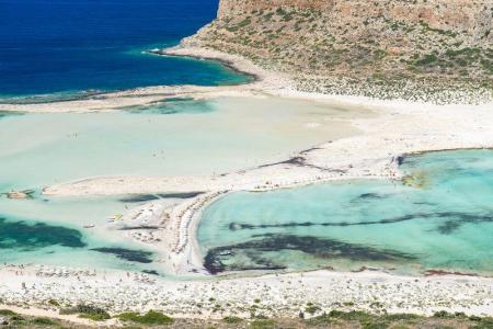
Villa Iasonas
An old residence renovated completely in 2015 is between the old stone houses of the traditional settlement of Kournas Apokoronas. Villa Iasonas keeps the traditional…
110 results found
An old residence renovated completely in 2015 is between the old stone houses of the traditional settlement of Kournas Apokoronas. Villa Iasonas keeps the traditional…

A stunning route who combine the tradition of the island, the beautiful beaches, the legends and the beauty of mother nature. This route with starting point...

From the picturesque village of Vassiliki we are heading to the gorge of Agios Savas, the first station on the beach of Tripiti. Near Tripiti the gorge narrows...

Location South of Rethymno, between Plakias and Preveli Scenery Fjord with towering cliffs and crystal-clear waters Access Accessible by road from…

Location 3 km from the village of Fodele, 26 km from Heraklion Beach Sandy with crystal-clear turquoise waters and Blue Flag Amenities Western part…

In front of the monastery of Koudoumas is a beautiful and very clean beach. You can enjoy swimming in the cool water of the sea as long as you respect the area…

The beautiful and lonely beach of Agios Nikitas is behind the Asterousia mountains in the bosom of the southern Cretan sea. In order to visit the beach, you should…

The Agiofarago climbing spot is in the Agiofarago gorge, in the south of the Heraclion prefecture, of Festos municipality. It is the southernmost climbing place…

Location 26 km east of Chania Access Through the village of Palailoni Parking Small parking area near the beach Natural beauty Impressive cliffs…

Location Chania, Crete Population 53,000 inhabitants Architecture A blend of Venetian, Ottoman, and traditional architecture Old and Modern City Chania is divided…

Location Aradena Gorge is located in Sfakia, Crete, and extends from the abandoned village of Aradena to the sea Length The gorge stretches over approximately…

Location 8 km west of Chora Sfakion Beach Features Pebbles, deep clear waters, tamarisk trees for shade Freshwater Springs Drinkable water springs…

Location South of Sfakia, 75 km from Chania. Historical Interest Venetian castle and the legend of the Drosoulites. Beaches Main beach, Orthi Ammos,…

Location 20 km from Chania, northeastern Akrotiri Peninsula Access From Chordaki, 10-15 minute hiking trail Facillities No organized facilities Name derived from…

Location Western Crete, Gramvousa Peninsula Timeline 4th and 3rd centuries BCE Significance Major trade hub, connected with Alexandria Currency Featured a woman’s…

Location 60 km west of Chania, Crete Beaches Award-winning Pachia Ammos, other smaller beaches to the north and south Activities Windsurfing, water sports Archaeology…

The fortress of Gramvousa is on a steep hill of the Imeri Gramvousa Island, opposite the famous Mpalos beach. The building of the fortress started in 1584 by the…

Location 72 km southwest of Chania, overlooking the Libyan Sea Architecture A dazzling white monastery with fortress-like architecture perched on a 35-meter…

Location 70 km southwest of Chania, built on a peninsula between two bays Sights the Venetian fortress of Selino, the Museum of the Akrites of Europe…
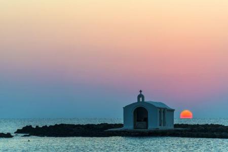
Location 40 km east of Chania, 20 km west of Rethymno Rivers Almyros and Perastikos, contributing to the natural lake and lush vegetation Beach 10…

Location 71 km south of Chania Access By foot or boat from Sfakia, Agia Roumeli, Sougia, Paleochora, Gavdos. History Connected to the ancient city…

Location 58 km south of Chania Natural Environment Exit of the Samaria Gorge Access By hiking or sea transport Beaches Main beach split…

Location 42 km south of Chania city Length 18 kilometers, with a hiking duration of 4-8 hours National Park Declared in 1962, part of the UNESCO…
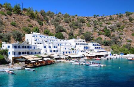
Location 2 km east of Chora Sfakion Natural Landscape Rocky terrain, steep cliffs, rich flora with holm oaks, pines, cypresses, and stone pines Hiking The…

Location 75 km southeast of Chania History Unsubdued by conquerors from the Arab period through the Turkish occupation Activities Hiking on the E4…

The fourteenth route of the E4 European Long Distance Path in Crete is 18 kilometers and lasts about 6 hours. You can take it during the whole year, it is not a…

The seventh route of the E4 European Long Distance Path is 19,5 kilometers long and lasts 5 hours and 30 minutes, You can follow it during the whole year, it has…

The sixth route of the E4 European long distance path is about 13 kilometers and lasts 3 hours and 30 minutes. The best time to take it is the whole year and, especially…

The fifth route of the E4 European Long Distance Path in Crete is 20 kilometers long and lasts 8 to 9 hours. You should follow it from April to September and the…

The fourth route of the E4 European long distance Path is about 14,5 kilometers and lasts about 4 and a half hours. The ideal time of the year in order to visit…

The third route of the E4 European long distance path is about 22 kilometers and lasts 5 hours. Its best visiting time of the year is spring, summer and autumn.…

The E4 European long distance path of Crete starts from Kasteli Kissamou of the Chania prefecture. The total length of the Kasteli Kissamou-Sfinari route is about…

Location South of Rethymno, 35 km away Amenities Hotels, cafés, tavernas, shops, post office, guesthouses Activities Water sports, boat trips to…

The Kourtaliotis River is the most famous in Crete as the Preveli palm forest is near the place where it discharges. Kourtaliotis is called “Megalos Potamos” (i.e.…

Panormo is a traditional, coastal settlement of the Milopotamos municipality and the Rethimno prefecture. The picturesque village is about 22 kilometers from Rethimno…

Mpali in the Rethimno prefecture is one of the most beautiful tourist places of the northern beaches of Crete. The coastal settlement is 32 kilometers from Rethimno…

Rodakino is one of the largest villages of the southern Rethimno prefecture. The village is on the foot of the Krioneritis Mountain, above the Rodakino beaches.…

The imposing Kourtaliotiko gorge starts from the Koksare village of the Rethimno prefecture, about 22 kilometers from Rethimno and ends to the amazing beach of…

The picturesque settlement of the Agios Vasileios municipality in the Rethimno prefecture, Sachtouria, is in a very beautiful area, in the north-western side of…

One of the most beautiful beaches of Crete is Agios Pavlos in the southern side of the Rethimno prefecture. It is 55 kilometers from Rethimno and, in order to visit…

Agia Galini is a very picturesque coastal settlement, 60 kilometers from Rethimno and about 70 kilometers from Heraclion. It “hangs” over the beautiful small port…

Location Αbout 75 km from Heraklion city Beach Quiet, unexplored, with sand and pebbles Facilities Limited, with taverns and a few accommodations…

Location 15 km from Heraklion on the national road to Chania Historical Significance Venetian fortress built in 1573 to protect the Gulf of Heraklion…

Location 16 km from Lentas Gorge Length Approximately 8 km, starting narrow and widening near the sea Access Dirt road connecting Trypiti with Loutra,…

Location 23 km northwest of Heraklion Residents Around 120 people History Mentioned in Venetian censuses as the fief of the Modinos brothers…

Location Between Tsoutsouros and Kastri, Southern Crete Beach Features Coarse sand, rocks, clean South Cretan Sea waters Facilities Unorganized beach…

Location 80 km from Heraklion, secluded beach with towering cliffs and emerald waters Attractions Chapel of St. Anthony, with a well of drinking water,…

Location Located approximately 60 km south of Heraklion Population The settlement is divided into Tsoutsouros and Pera Tsoutsouros, with the population significantly…

Location 20 km west of Heraklion, 2 km from Agia Pelagia Beach Turquoise waters, coarse sand, sheltered from winds Facilities Sunbeds, umbrellas,…

Location 22km northwest of Heraklion, near Agia Pelagia Beach Type Pebbly beach, crystal-clear waters, sheltered from winds Facilities Sunbeds, umbrellas,…

Fodele, a picturesque village on Crete’s northern coast, is located 25 km west of Heraklion, along the national road to Chania. The village is set in a lush green…

Location 14th km of the Heraklion – Rethymno National Road Small Port Picturesque harbor with traditional taverns offering fresh seafood Beach A…

Location 8 km from Heraklion, a coastal village in the Malevizi municipality. Historical Significance Venetian fortress built on the acropolis of the…

Location 20 km west of Heraklion Nature and landscape Lush vegetation, beaches with crystal-clear waters Beaches Main beach, Filakes, Kladissos,…

Location 90 kilometers southeast of Heraklion Beach Dark gray sand, clean and calm waters, organized with sunbeds and umbrellas Activities Water sports, beach…

Location It starts from the village of Hondros, municipality of Viannos, and ends near Keratokampos Length 4.6 kilometers River The Keratokampitis…

Location 64 km from Heraklion Attractions Picturesque chapels such as Saint Theodore, Saint Fanourios, Saint Nicholas, and Portela Gorge Population Approximately…

Location 90 km from Heraklion, 25 km from Ierapetra Population Approximately 70 residents, primarily engaged in agriculture Beach Coarse sand, unorganized,…

Location 70 km southeast of Heraklion Beach 7 km long, with coarse pebbles and golden sand Gorges Portela Gorge History Ruins of the ancient city of Keraia…

Location 70 km southeast of Heraklion Facilities Taverns, cafes, rental rooms Harbor Small harbor serving local fishermen Beaches Western small…

Location The gorge is located in Arvion Mountain, near the village of Arvi Waterfall The Kapnisti waterfall has a height of approximately 80 meters Access Ideal…

Arvi is a coastal settlement of the Viannos municipality, 80 kilometers from Heraklion and 35 kilometers from Ierapetra. The settlement is in front of a valley…

Location 65 km south of Heraklion Altitude 80 meters Attractions Traditional village with tourist facilities History Inhabited since 961 A.D.…

Location 67 km from Heraklion and 2.5 km from Tympaki Beaches Two beaches: Katalyki (organized, sandy) and a western, unorganized beach (rocky and pebbly)…

Location 67 km south of Heraklion Beach The largest beach in southern Crete (2.5 km) with coarse sand and a rocky seabed Activities Ideal for water…

The Treis Ekklisies (i.e. three churches) coastal settlement is behind the imposing Asterousia Mountains in the end of the Ampas gorge. It is an area that makes…

Platia Peramata is a small settlement in the middle of the dirt road that connects Kaloi Limenes with Lentas. The settlement is 70 kilometers from Heraklion. A…

The village of hippies, Matala, is approximately 70 kilometers in the south of Heraclion and is one of the most famous coastal settlements of the southern Crete.…

Chrisostomo is a small coastal settlement, approximately 75 kilometers from Heraclion and 2 kilometers in the east of Kaloi Limenes. According to findings, the…

Many beautiful and clean beaches are in Kaloi Limenes. Kaloi Limenes is 77 kilometers from Heraclion and it can be accessed by the asphalted road that goes through…

The Agios Savvas gorge is one of the most beautiful and imposing gorges of the Asterousia Mountains. Its length is 4 kilometers and, then, it is connected with…

The coastal settlement of Lentas, of the Gortyna municipality, is built on the ruins of the ancient city of Levin ( «Λεβήν»). Lentas is in the southern sides of…

“In Kapetaniana, whoever believes in God, he talks to Him”, Thanos Mikroutsikos. A heaven on Earth is in the holly hill of Kofina and stares the Libyan sea. Kapetaniana…

The monastery of Koudoumas is very well protected by the imposing Asterousia Mountains, in the south of the cape of Martelos, and by the Libyan sea in the south.…

The entrance of the secured gorge of Eligia is in the dirt road that connects Kapetaniana with the coastal settlement of Agios Ioannis. A few meters before the…

The Vasiliki village is near the Asterousia Mountains, 260 meters above the sea level and 56 kilometers from Heraclion. The Vasiliki community includes Vasiliki…

The cave of Agios Antonios is in a lonely area at about the middle of the path that connects the settlement of Agios Ioannis with the monastery of Koudoumas. If…

The path which connects the monastery with the coastal settlement of Agios Ioannis is in the west of the monastery of Koudoumas. The route is easy and lasts about…
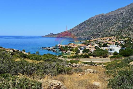
The settlement of Agios Ioannis is a few meters from Kapetaniana, after a winding, dirt road. It its built along the Ponta peninsula . A wonderful beach with blue…

The coastal settlement of Maridaki is about 65 kilometers from Heraclion, behind the Asterousia Mountains. The small village is built at the end of the imposing…

The monastery of Agios Nikitas is about 65 kilometers in the south of Heraclion behind the the imposing Asterousia mountains. Administratively, the monastery falls…

Location Northeastern Lasithi, 70 km from Agios Nikolaos Beaches Sitia's main beach, Blue Flag-awarded, 2.5 km long, with organized facilities and water…

Location 18 km east of Ierapetra Hiking Route Approximately 20-minute hike on a moderate trail, accessible from the village of Agios Ioannis (elevation…

Location Northern Lasithi region, near Exo Mouliana village, 25 km from Sitia Length Approximately 3 km Waterfall Richtis Waterfall, about 20 meters…

Location 5 km west of Ierapetra, 39 km south of Agios Nikolaos Wetland Bramiana Dam, an important wetland and bird sanctuary Population 1,528 inhabitants…

Location 12 km from Ierapetra, 45 km from Agios Nikolaos Beach Fine pebbles, crystal-clear waters, Blue Flag awarded Natural Beauty Surrounded by…

Kserokampos is one of the most beautiful beaches of the eastern Crete. Kserokampos is a settlement about 48 kilometers from Siteia and 28 kilometers from Palaikastro.…

The gorge of Nekroi in Zakros is a very beautiful and important archaeologically gorge. Its name (“nekroi” means the dead, in Greek) came from the large number…
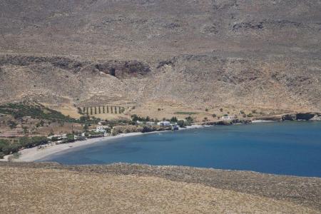
The calm Kato Zakros beach is behind mountains and the plants of the green valley of Zakros. The beach is pebbly and at the edge of the large bay. It is not organized…

Zakros is one of the most picturesque villages of Crete that combines the natural beauty with the alternative activities and the important archaeological sites.…

Mirtos is a picturesque and tourist coastal settlement of the Lasithi prefecture. It is built near the banks of the Krios River, close to the exit of the imposing…

Makris Gialos is a small coastal settlement 24 kilometers in the east of Ierapetra, 35 kilometers in the west of Siteia and 60 kilometers from Agios Nikolaos. Makris…

The awarded city for its wonderful beaches, Ierapetra, is the unique city in the southern Crete and the last city in the southern end of Europe. Ierapetra is about…

The amazing and magnificent Elounta is known for the powerful and famous people from all over the world that visit it. Its beaches, its clean, blue sea, and the…

Agios NIkolaos, the beautiful capital of the Lasithi prefecture, is in the west side of the Meramvelo peninsula. The Voulismeni Lake in the center of the city is…