


From the palace of Minoas to the cool gorge
Many people know its existence, its history and have visited it. It is Knossos, the house of Minoas. It is known to everyone living in Crete or visiting it....
105 results found
Many people know its existence, its history and have visited it. It is Knossos, the house of Minoas. It is known to everyone living in Crete or visiting it....

From the picturesque village of Vassiliki we are heading to the gorge of Agios Savas, the first station on the beach of Tripiti. Near Tripiti the gorge narrows...

Location Aradena Gorge is located in Sfakia, Crete, and extends from the abandoned village of Aradena to the sea Length The gorge stretches over approximately…

Location 42 km south of Chania city Length 18 kilometers, with a hiking duration of 4-8 hours National Park Declared in 1962, part of the UNESCO…
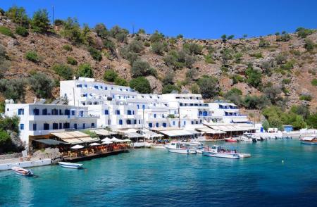
Location 2 km east of Chora Sfakion Natural Landscape Rocky terrain, steep cliffs, rich flora with holm oaks, pines, cypresses, and stone pines Hiking The…

Location 8 km south of Rethymno Trail About 1.5 hours of easy hiking through lush greenery Natural features Rich vegetation with plane trees, fig…

Location 30 km from Heraklion Length 5 km, with an estimated walking time of 1 hour Trail Easy and accessible year-round, with dense vegetation and…

The imposing Kourtaliotiko gorge starts from the Koksare village of the Rethimno prefecture, about 22 kilometers from Rethimno and ends to the amazing beach of…

Location 16 km from Lentas Gorge Length Approximately 8 km, starting narrow and widening near the sea Access Dirt road connecting Trypiti with Loutra,…

Location Starts from Ano Archanes and ends near Knossos, Crete Length Approximately 6 km Main Points Sylamiano Gorge (accessible by car), Kato Mylos,…

Location It starts from the village of Hondros, municipality of Viannos, and ends near Keratokampos Length 4.6 kilometers River The Keratokampitis…

Location The gorge is located in Arvion Mountain, near the village of Arvi Waterfall The Kapnisti waterfall has a height of approximately 80 meters Access Ideal…

The impressive Ampa gorge is near Pananimfoi, in the Arxanes-Asterousia Municipality. Ampas is known to the locals for its natural beauty that includes also the…

The gorge of Venerato is a very small gorge, 500 meters long and with a natural beauty. The gorge is between Venerato and the Paliani Monastery and 17 kilometers…

The gorge starts from the small Agios Charalampos church in the south of the Ano Asites settlement. The small gorge is easily accessed, particularly in the summer,…

The path to the green gorge of Agios Nikolaos with the amazing waterfalls starts from the Zaros Lake and ends to one of the forest of Greece, the Rouvas forest.…

The entrance of the gorge of Vorizia is in a dense planted area full of oaks, in the east of Vorizia. The gorge ends to the amazing landscapes of the Nida plateau.…

The entrance of the secured gorge of Eligia is in the dirt road that connects Kapetaniana with the coastal settlement of Agios Ioannis. A few meters before the…

The beautiful gorge of Achentrias crosses the Asterousia mountains and reaches the Cretan sea. The Achentrias gorge starts from the settlement of Achentrias and…

The gorges of Astrakias, Kunavi and Karteros are parts of the wide geographical cluster from where the E4 European long distance path passes by. Its total length…

Location 18 km east of Ierapetra Hiking Route Approximately 20-minute hike on a moderate trail, accessible from the village of Agios Ioannis (elevation…

Location Northern Lasithi region, near Exo Mouliana village, 25 km from Sitia Length Approximately 3 km Waterfall Richtis Waterfall, about 20 meters…

The gorge of Nekroi in Zakros is a very beautiful and important archaeologically gorge. Its name (“nekroi” means the dead, in Greek) came from the large number…

The gorge of Sarakina or Sarantapichos starts from the Mithoi settlement of Ierapetra and ends to the coastal Mirtos settlement. Its entrance is about 16 kilometers…

The Kritsa gorge is in a very beautiful area. It starts from the north-east side of the Kritsa settlement and ends after about 12 kilometers, to the Tapes village.…

The flora of Crete is very important due to the mild and hot climate. There are 2000 different plant species and 160 of them are indigenous. The large number of…

The Agiofarago climbing spot is in the Agiofarago gorge, in the south of the Heraclion prefecture, of Festos municipality. It is the southernmost climbing place…

Location: 50 km from Chania in the village of Topolia Chapel of Agia Sophia Inside the cave is a charming chapel dedicated to Saint Sophia Natural Decor: The…

Location Tavris Plateau near Askifou Altitude1,200 m Access 7.5 km dirt road or a 2-hour hike from Ammoudari Facilities 45 people capacity,…

Location Southeast of the Omalos Plateau, at an altitude of 1,680 meters View Panoramic views of the Cretan and Libyan Seas, the Samaria Gorge, and Gavdos…

Location South of Sfakia, 75 km from Chania. Historical Interest Venetian castle and the legend of the Drosoulites. Beaches Main beach, Orthi Ammos,…

Location 16 km from Chania, nestled at the foot of the White Mountains Main Attractions Theriso Gorge, Cretan Revolution Museum, Venizelos’ headquarters…

Location 71 km south of Chania Access By foot or boat from Sfakia, Agia Roumeli, Sougia, Paleochora, Gavdos. History Connected to the ancient city…

Location 58 km south of Chania Natural Environment Exit of the Samaria Gorge Access By hiking or sea transport Beaches Main beach split…

Location 75 km southeast of Chania History Unsubdued by conquerors from the Arab period through the Turkish occupation Activities Hiking on the E4…

The tenth route of the E4 European long distance Path is about 18 kilometers and lasts 6 hours and 30 minutes. The time it has to be followed is from May to October(due…
The ninth route of E4 European Long Distance Path is 13,5 kilometers and takes 7 hours and 30 minutes to follow it. The best season of the time to follow it is…

The eighth route of the E4 European Long Distance Path is about 24,5 kilometers and lasts 8 hours. It is better to follow it in spring or autumn, it is not a difficult…

The sixth route of the E4 European long distance path is about 13 kilometers and lasts 3 hours and 30 minutes. The best time to take it is the whole year and, especially…

The fifth route of the E4 European Long Distance Path in Crete is 20 kilometers long and lasts 8 to 9 hours. You should follow it from April to September and the…

The fourth route of the E4 European long distance Path is about 14,5 kilometers and lasts about 4 and a half hours. The ideal time of the year in order to visit…

The third route of the E4 European long distance path is about 22 kilometers and lasts 5 hours. Its best visiting time of the year is spring, summer and autumn.…

Location South of Rethymno, 35 km away Amenities Hotels, cafés, tavernas, shops, post office, guesthouses Activities Water sports, boat trips to…

Location Rethymno, 25 km from Rethymno and 95 km from Heraklion Ecological Significance One of the most important wetlands in the southeastern Mediterranean…

The Kourtaliotis River is the most famous in Crete as the Preveli palm forest is near the place where it discharges. Kourtaliotis is called “Megalos Potamos” (i.e.…

The Monastery of Arkadi combines the natural beauty with its important history and legends. It is about 23 kilometers from Rethimno, in a very green plateau, in…

Nida is the highest plateau in Crete as it is about 1.450 meters above the sea level and surrounded by the imposing mountains of Psiloreitis. It is a very beautiful…

Spili is a traditional, mountain settlement of the Agios Vasileios municipality in the Rethimno prefecture. The settlement is built amphitheatrically, on the western…

Sellia is a village of the Agios Vasileios municipality and the Rethimno prefecture. Its local community is consisted of the settlements of Souda and Plakias. According…

Rodakino is one of the largest villages of the southern Rethimno prefecture. The village is on the foot of the Krioneritis Mountain, above the Rodakino beaches.…

Location 75 km from Heraklion, 13 km from Lentas Access Dirt road from Krotos village, 4 km to the hill, 10-minute walk to the church Tradition Miraculous…

Neraidospilios is 20km south of Heraklion, in the green gorge of Astraki. According to the legend, in the Fairy Cave of Astrakas located in the gorge of Karteros,…

Location on Mount Dikti, 53 km from Heraklion Elevation 1,188 meters Inhabitants Around 230 Natural Environment The village is the endpoint…

Location 38 km from Ierapetra Altitude 560 m Attractions Agia Moni Monastery, churches of Agia Pelagia, Agios Georgios Population 900…

Location near Kato Archanes Activities Hiking, mountain biking Archaeological Significance Largest prehistoric cemetery in the Aegean (2400 B.C.…

Location 53 km from Heraklion, on the southern slopes of Mount Psiloritis Attractions The Monastery of Varsamonero, dating back to the 18th century, is…

Location 80 km from Heraklion, secluded beach with towering cliffs and emerald waters Attractions Chapel of St. Anthony, with a well of drinking water,…

Location 8 km from Heraklion, a coastal village in the Malevizi municipality. Historical Significance Venetian fortress built on the acropolis of the…

Location 64 km from Heraklion Attractions Picturesque chapels such as Saint Theodore, Saint Fanourios, Saint Nicholas, and Portela Gorge Population Approximately…

Location 70 km southeast of Heraklion Beach 7 km long, with coarse pebbles and golden sand Gorges Portela Gorge History Ruins of the ancient city of Keraia…

Location 74 km from Heraklion, 30 km from Ierapetra. Natural environment A lush valley with rich vegetation and fruit-bearing trees Natural attractions Blavopotamos…

Location Exit of Arvi Gorge, 90 km from Heraklion History Built on the ruins of the temple of Arvios Zeus Religious significance Two churches dedicated…

Arvi is a coastal settlement of the Viannos municipality, 80 kilometers from Heraklion and 35 kilometers from Ierapetra. The settlement is in front of a valley…

Just a few kilometers north of Heraklion, only 8 km from the city center, lies the picturesque area of Agia Irini, a green haven of peace, perfect for a quick escape…

The Treis Ekklisies (i.e. three churches) coastal settlement is behind the imposing Asterousia Mountains in the end of the Ampas gorge. It is an area that makes…

The picturesque Panagia Spiliotissa monastery is between Agios Vasileios and Choudetsi and 22 kilometers from Heraclion. In order to reach the monastery, you have…

The path in the Agios Charalampos gorge is a part of the E4 European long distance route. Following the route, you can go through the impressive Agios Antonios…

The Kerasia settlement is built on the eastern sides of the Chalepa hill, 340 meters above the sea level, on the 20th kilometer of the national Heraclion-Mesara…

Venerato is a village of the Heraclion municipality, 20 kilometers from the Heraclion city. Administratively the district is consisted of Venerato, the Paliani…

Avgeniki is a village of the Heraclion municipality, on the 20th kilometer of the Heraclion-Timpaki road. The entrance of the Venerato gorge is near the settlement…

Ano Asites is a settlement of the former Malevizi district of the Heraclion municipality. It is a village of a high environmental, cultural and archaeological interest.…

The small temple of Agios Nikolaos from the 14th century is only preserved today from the important Zaros monastery. The church is 900 meters from the southern…

The beautiful and interesting town of Zaros is built 45 kilometers from Heraclion and is included in the Festos municipality. It is in the southern foot of the…

The Agios Savvas gorge is one of the most beautiful and imposing gorges of the Asterousia Mountains. Its length is 4 kilometers and, then, it is connected with…

The picturesque village of Sokaras is 50 kilometers from Heraclion between olive trees and fertile vineyards and garden produce of the plain of Mesara. Places of…

The coastal settlement of Lentas, of the Gortyna municipality, is built on the ruins of the ancient city of Levin ( «Λεβήν»). Lentas is in the southern sides of…

The small settlement of Koumasa is famous for the imposing gorge of Agios Savvas that starts from the southern side of the village and it is 4 kilometers long.…

The monastery of Koudoumas is very well protected by the imposing Asterousia Mountains, in the south of the cape of Martelos, and by the Libyan sea in the south.…

The Vasiliki village is near the Asterousia Mountains, 260 meters above the sea level and 56 kilometers from Heraclion. The Vasiliki community includes Vasiliki…
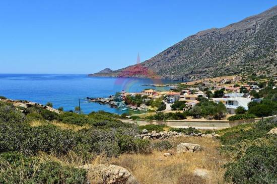
The settlement of Agios Ioannis is a few meters from Kapetaniana, after a winding, dirt road. It its built along the Ponta peninsula . A wonderful beach with blue…

The coastal settlement of Maridaki is about 65 kilometers from Heraclion, behind the Asterousia Mountains. The small village is built at the end of the imposing…

Kounavoi, the traditional village of Archanes-Asterousia Municipality, is where the Minoan city of Eltinia was. The settlement dominates in a small plain in the…
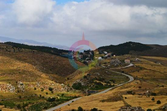
One of the most beautiful and traditional Cretan villages of Crete is Ethia in the Archanes-Asterousia Municipality. The village is about 55 kilometers from Heraclion,…

The small settlement of Damania is about 35 kilometers from Heraclion, built in the Southeastern sides of Ofis hummock and 420 meters above the sea level in the…

In the Achentrias settlement, in the Archanes-Asterousia municipality of the prefecture of Heraclion, there are many hiking options. You can either wander in the…
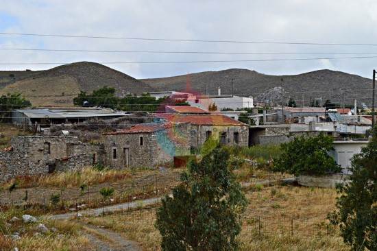
The picturesque mountainous village of Achentrias is 60 kilometers from Heraclion and 680 meters above the sea level. Administratively, it falls under the Archanes-Asterousia…

In Kato Vrisi, in Astritsi, someone can find a forgotten part of the paradise. Administratively, Astritsi belongs to the Archanes- Asterousia Municipality,…

Astraki is famous for its beautiful gorge that goes by the same name and it starts from there and also for the old Turkish quarter. The village is from the 12th…

Agies Paraskies is built on a 360-meter hummock with a magnificent view. It is 20 kilometers in the south east of Heraclion and, administratively belongs to the…

Location 9 km east of Makry Gialos Church Two-aisled cave church dedicated to Saint John the Baptist and the Holy Trinity Buildings Monks' cells,…

Location 70 km from Heraklion Altitude 900 meters History Inhabited since the Neolithic era, it remained uninhabited during the Venetian era due…

The Preveli Monastery is about 35 kilometers in the south of Rethimno and the famous and beautiful palm forest is next to it. The monastery is in the west of the…

Kserokampos is one of the most beautiful beaches of the eastern Crete. Kserokampos is a settlement about 48 kilometers from Siteia and 28 kilometers from Palaikastro.…

The Minoan Palace of Zakros is the fourth largest ancient palace in Crete after those of Knosos, Festos and Malia. It is 500 meters from Kato Zakros, 8 kilometers…

Zakros is one of the most picturesque villages of Crete that combines the natural beauty with the alternative activities and the important archaeological sites.…

The Cha gorge of the Ierapetra municipality and Lasithi prefecture has about 25 descents, slides and jumps. Water dominates and creates many waterfalls and places…

Mirtos is a picturesque and tourist coastal settlement of the Lasithi prefecture. It is built near the banks of the Krios River, close to the exit of the imposing…

Makris Gialos is a small coastal settlement 24 kilometers in the east of Ierapetra, 35 kilometers in the west of Siteia and 60 kilometers from Agios Nikolaos. Makris…


