


From the Palaces and historical places to the dew of the Cretan Sea
From ancient Gortyna to the picturesque village of Sivas, from Sivas to the historic and beautiful monastery Odigitrias and from the monastery Odigitrias to...
74 results found
From ancient Gortyna to the picturesque village of Sivas, from Sivas to the historic and beautiful monastery Odigitrias and from the monastery Odigitrias to...

Kapetanakeio is one of the historical buildings of Heraclion that dominates in one of the most beautiful spots of the city. The 1stGymnasium of Heraclion, theoldest…

The Historical Museum of Heraclion is in the coastal road, on the 27th of Sofoklis Venizelos Street. The Historical Museum of Heraclion was founded by the Society…

The Cretan dialect includes words that came from and were influenced by the various nations inhabited in Crete that were adapted and changed in order to have the…

Location Emprosnero, Municipality of Apokoronas, 40 km from Chania History Built by Venetians, reconstructed by Turks, destroyed by Sfakians in 1774 Architecture Four…

Location Between the villages of Vryses and Maza Access Chania-Rethymno National Road Other attractions Lush vegetation, springs, and the chapel…

Location Chania, Crete Population 53,000 inhabitants Architecture A blend of Venetian, Ottoman, and traditional architecture Old and Modern City Chania is divided…

Location South of Sfakia, 75 km from Chania. Historical Interest Venetian castle and the legend of the Drosoulites. Beaches Main beach, Orthi Ammos,…

Location 16 km from Chania, nestled at the foot of the White Mountains Main Attractions Theriso Gorge, Cretan Revolution Museum, Venizelos’ headquarters…

Location Western Crete, Gramvousa Peninsula Timeline 4th and 3rd centuries BCE Significance Major trade hub, connected with Alexandria Currency Featured a woman’s…

Location 26 km southeast of Chania Architecture Traditional kamarospita and konakia, built using local materials Attractions Old neighborhood, restored…

Location 11 km from Chania city, near the airport History Mentioned in Venetian censuses since 1583. Named after Venetian lord Aronis Attractions The…

Location 71 km south of Chania Access By foot or boat from Sfakia, Agia Roumeli, Sougia, Paleochora, Gavdos. History Connected to the ancient city…

Location 58 km south of Chania Natural Environment Exit of the Samaria Gorge Access By hiking or sea transport Beaches Main beach split…

Location 54 km from Heraklion Population Approximately 180 residents Settlements Pera Martha (Evangelismos) and Pode Martha (Saint John the Theologian)…

Location 2 km from Melidoni village, 27 km from Rethymno Altitude 220 meters Stalactite Chambers Heroes' Room, Crossroads, Pasley, Sinkhole Chamber Historical…

Location South of Rethymno, 35 km away Amenities Hotels, cafés, tavernas, shops, post office, guesthouses Activities Water sports, boat trips to…

Location 8 km south of Rethymno Trail About 1.5 hours of easy hiking through lush greenery Natural features Rich vegetation with plane trees, fig…

Location 40 km from the city of Rethymno, at the foothills of the Talaios mountains Population 305 residents (census) Attractions Turkish prisons,…

The Lappa ancient city was one of the most important cities in Crete that, according to the Mycenaean traditions, was founded by Agamemnonas. Lappa was in the place…

Mpali in the Rethimno prefecture is one of the most beautiful tourist places of the northern beaches of Crete. The coastal settlement is 32 kilometers from Rethimno…

The Idaion Antron is near the picturesque town of Anogeia with the important history and the impressive myths. The cavern is 1500 meters above the sea level and…

Nida is the highest plateau in Crete as it is about 1.450 meters above the sea level and surrounded by the imposing mountains of Psiloreitis. It is a very beautiful…

Location Gerokambos Vaulted tombs Dating from the Late Minoan period Findings in the tombs Pottery, jewelry, tools that reflect burial customs and…

Location 15 km from Heraklion on the national road to Chania Historical Significance Venetian fortress built in 1573 to protect the Gulf of Heraklion…

Location 34 km from Heraklion Αltitude 340 meters History Discoveries of a Minoan settlement and the town’s name deriving from an ancient fortress…

Location: 27 km southeast of Heraklion Archaeological interest Acropolis of Smari, ancient settlement, significant finds Natural beauty Picturesque alleys,…

Location 23 km northwest of Heraklion Residents Around 120 people History Mentioned in Venetian censuses as the fief of the Modinos brothers…

Location 50 km south of Heraklion, at the foot of the Asterousia Mountains Population 1,000 residents (2011 census) Landmark The "Charaki" rock with…

Location50 km southeast of Heraklion, in the municipality of Minoa Pediada Altitude Approximately 250 meters Residents Around 300 Historical landmarks Five…

Location on Mount Dikti, 53 km from Heraklion Elevation 1,188 meters Inhabitants Around 230 Natural Environment The village is the endpoint…

Location 10 km east of Ano Viannos Elevation 2,141 meters Inhabitants Approximately 317 History First mentioned in 1583 by Kastrofylakas Churches Churches…

Location 50 km from Heraklion and 15 km from Ano Viannos Elevation 430 meters Inhabitants Approximately 430 History Mentioned r in documents…

Location: Viannos Municipality, southern slopes of Mount Dikti Altitude: 680m Population: 850 (Amiras and Arvi) Occupations: Agriculture, early vegetable cultivation…

The historical and folklore Museum of Viannos was found in 1996 and exhibits many important objects. Some agricultural tools are exhibited and the professions of…

Location 15 km from Heraklion Altitude 360 m. Activities Hiking on the E4 trail, visit to the Museum of Cretan History Sights Archaeological site in Fourni, amazing…

Location near Kato Archanes Activities Hiking, mountain biking Archaeological Significance Largest prehistoric cemetery in the Aegean (2400 B.C.…

Location 53 km from Heraklion, on the southern slopes of Mount Psiloritis Attractions The Monastery of Varsamonero, dating back to the 18th century, is…

Location 20 km west of Heraklion, 2 km from Agia Pelagia Beach Turquoise waters, coarse sand, sheltered from winds Facilities Sunbeds, umbrellas,…

Fodele, a picturesque village on Crete’s northern coast, is located 25 km west of Heraklion, along the national road to Chania. The village is set in a lush green…

Location Rodia, Municipality of Malevizi Era First half of the 15th century Architecture A three-story Venetian structure with storage and luxury…

Location 16 km northwest of Heraklion Population 1,326 residents, with 797 living in Rodia Venetian Mansion of Modinos A prime example of Venetian…

Location 8 km from Heraklion, a coastal village in the Malevizi municipality. Historical Significance Venetian fortress built on the acropolis of the…

Location Southwest of Heraklion Distance Ano and Kato Kalesia are about 300 meters apart Population Ano Kalesia ~300 residents, Kato Kalesia ~600…

Location Near Rogdia, 20 km from Heraklion History Founded during the Venetian period, a possible refuge for monks from coastal monasteries Architectural…

Location 20 km west of Heraklion Nature and landscape Lush vegetation, beaches with crystal-clear waters Beaches Main beach, Filakes, Kladissos,…

Location 90 kilometers southeast of Heraklion Beach Dark gray sand, clean and calm waters, organized with sunbeds and umbrellas Activities Water sports, beach…

Location 74 km from Heraklion, 30 km from Ierapetra. Natural environment A lush valley with rich vegetation and fruit-bearing trees Natural attractions Blavopotamos…

Location 45 km southeast of Heraklion. Population Approximately 175 residents Archaeological Interest The ancient city of Arcadia (Arkades) was located…

Arvi is a coastal settlement of the Viannos municipality, 80 kilometers from Heraklion and 35 kilometers from Ierapetra. The settlement is in front of a valley…

Location On a hill near Heraklion, 12 km from the city Population Approximately 830 residents History Mentioned in Venetian records. Damaged by the…

Just a few kilometers north of Heraklion, only 8 km from the city center, lies the picturesque area of Agia Irini, a green haven of peace, perfect for a quick escape…

Location 60 km south of Heraklion, near Zaros Altitude 380 meters Attractions Church of the Dormition of the Virgin Mary History Recorded since…

Location 20 km from Heraklion Building Housed in an old mansion in Houdetsi’s village square Founder and Artistic Director Ross Daly, artistic…
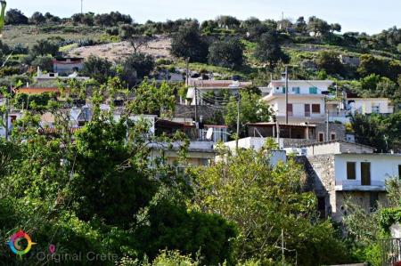
Location 23 km from Heraklion Αltitude of 440 m. Population Approximately 863 residents Main occupations Agriculture, tourism, trade, and technical…

Kouses is a historical village of the former Kainourio district and of the Festos municipality. The village is on the northern foot of the Pirgos hummock of the…

The beautiful male monastery of Odigitria is in the western end of the Asterousia Mountains, 250 meters above the sea level, near Agiofarago and Martsalo. The area…

The restored water mill of Mix. Fragiadakis is in Zaros on the road that starts from the Votomos man-made lake. It has declared a preserved historical monument…

The beautiful and interesting town of Zaros is built 45 kilometers from Heraclion and is included in the Festos municipality. It is in the southern foot of the…

“In Kapetaniana, whoever believes in God, he talks to Him”, Thanos Mikroutsikos. A heaven on Earth is in the holly hill of Kofina and stares the Libyan sea. Kapetaniana…

Kounavoi, the traditional village of Archanes-Asterousia Municipality, is where the Minoan city of Eltinia was. The settlement dominates in a small plain in the…

The gorges of Astrakias, Kunavi and Karteros are parts of the wide geographical cluster from where the E4 European long distance path passes by. Its total length…

Alagni is a village in the Archanes- Asterousia Municipality and is closely connected to mythology, history and tradition. Alagni is 25 kilometers from Heraclion,…

Agies Paraskies is built on a 360-meter hummock with a magnificent view. It is 20 kilometers in the south east of Heraclion and, administratively belongs to the…

Location 12 km from Agios Nikolaos, 3 km from Neapolis Population 174 residents (2011) History Inhabited since the Late Minoan era, an important…

Location 16 km from Agios Nikolaos Population 205 residents (2011 census) History Settled since 1400, the name comes from the Venetian word "Kastelium."…

Location Northern Lasithi region, near Exo Mouliana village, 25 km from Sitia Length Approximately 3 km Waterfall Richtis Waterfall, about 20 meters…

Location 9 km east of Makry Gialos Church Two-aisled cave church dedicated to Saint John the Baptist and the Holy Trinity Buildings Monks' cells,…

Location Northeast of the village of Milatos Archaeological Importance The cave has been in use since the Neolithic period Structure The cave consists…

The Minoan Palace of Zakros is the fourth largest ancient palace in Crete after those of Knosos, Festos and Malia. It is 500 meters from Kato Zakros, 8 kilometers…

The island of the tears and the island of the leppers are some of the characterizations of the beautiful and historical Spinaloga. Spinaloga is in the north of…

Agios NIkolaos, the beautiful capital of the Lasithi prefecture, is in the west side of the Meramvelo peninsula. The Voulismeni Lake in the center of the city is…


