


Rivers in Crete
River is a system of internal water that flows on the surface of the earth and a large of its part can be underground. Very few rivers are in Crete due to its small…
51 results found
River is a system of internal water that flows on the surface of the earth and a large of its part can be underground. Very few rivers are in Crete due to its small…

The Platis or Amarianos River is supplied from the Amari valley and ends to the eastern side of the coastal settlement of Agia Galini. Platis was thought as the…

The Kourtaliotis River is the most famous in Crete as the Preveli palm forest is near the place where it discharges. Kourtaliotis is called “Megalos Potamos” (i.e.…

Location 4 km south of Georgioupolis, on the border of Chania and Rethymno History Ancient name "Korisia," current name from the Arab period Dimensions 579…
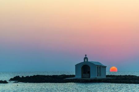
Location 40 km east of Chania, 20 km west of Rethymno Rivers Almyros and Perastikos, contributing to the natural lake and lush vegetation Beach 10…

Location 42 km south of Chania city Length 18 kilometers, with a hiking duration of 4-8 hours National Park Declared in 1962, part of the UNESCO…

The tenth route of the E4 European long distance Path is about 18 kilometers and lasts 6 hours and 30 minutes. The time it has to be followed is from May to October(due…

The ninth route of E4 European Long Distance Path is 13,5 kilometers and takes 7 hours and 30 minutes to follow it. The best season of the time to follow it is…

The sixth route of the E4 European long distance path is about 13 kilometers and lasts 3 hours and 30 minutes. The best time to take it is the whole year and, especially…

The fourth route of the E4 European long distance Path is about 14,5 kilometers and lasts about 4 and a half hours. The ideal time of the year in order to visit…

Location 30 km from Heraklion Length 5 km, with an estimated walking time of 1 hour Trail Easy and accessible year-round, with dense vegetation and…

Argyroupoli is one of the most beautiful villages of the Rethimno prefecture, on the hill between the springs of the Petre and Mousela Rivers after which the names…

The imposing Kourtaliotiko gorge starts from the Koksare village of the Rethimno prefecture, about 22 kilometers from Rethimno and ends to the amazing beach of…

Agia Galini is a very picturesque coastal settlement, 60 kilometers from Rethimno and about 70 kilometers from Heraclion. It “hangs” over the beautiful small port…

Location50 km southeast of Heraklion, in the municipality of Minoa Pediada Altitude Approximately 250 meters Residents Around 300 Historical landmarks Five…

Location 50 km from Heraklion and 15 km from Ano Viannos Elevation 430 meters Inhabitants Approximately 430 History Mentioned r in documents…

Location 35 km from Heraklion, in the municipality of Minoa Pediada Elevation Built on a hill near the Avliotiko River Inhabitants Approximately…

Fodele, a picturesque village on Crete’s northern coast, is located 25 km west of Heraklion, along the national road to Chania. The village is set in a lush green…

Location Near Rogdia, 20 km from Heraklion History Founded during the Venetian period, a possible refuge for monks from coastal monasteries Architectural…

Location 90 kilometers southeast of Heraklion Beach Dark gray sand, clean and calm waters, organized with sunbeds and umbrellas Activities Water sports, beach…

Location It starts from the village of Hondros, municipality of Viannos, and ends near Keratokampos Length 4.6 kilometers River The Keratokampitis…

Location 64 km from Heraklion Attractions Picturesque chapels such as Saint Theodore, Saint Fanourios, Saint Nicholas, and Portela Gorge Population Approximately…

Location 90 km from Heraklion, 25 km from Ierapetra Population Approximately 70 residents, primarily engaged in agriculture Beach Coarse sand, unorganized,…

Location 70 km southeast of Heraklion Beach 7 km long, with coarse pebbles and golden sand Gorges Portela Gorge History Ruins of the ancient city of Keraia…

Location 74 km from Heraklion, 30 km from Ierapetra. Natural environment A lush valley with rich vegetation and fruit-bearing trees Natural attractions Blavopotamos…

Just a few kilometers north of Heraklion, only 8 km from the city center, lies the picturesque area of Agia Irini, a green haven of peace, perfect for a quick escape…

The gorge of Venerato is a very small gorge, 500 meters long and with a natural beauty. The gorge is between Venerato and the Paliani Monastery and 17 kilometers…

Pentamodi is a quiet and picturesque village in the valley of the Gazanos River, 17 kilometers from Heraclion. Administratively, the village is under the extended…

The mountainous Marathos village of the Malevizi municipality is about 20 kilometers from Heraclion and 300 meters above the sea level. The Marathianos River is…

Faneromeni is a village of the Festos municipality and 4 kilometers from Timpaki. The Faneromeni local community also includes Kalivia and the Kaliviani monastery.…

The beautiful male monastery of Odigitria is in the western end of the Asterousia Mountains, 250 meters above the sea level, near Agiofarago and Martsalo. The area…

The male monastery of Vrontisi is in the southern foot of Psiloreitis, between the villages of Zaros and Vorizia, 550 meters above the sea level. Administratively…

Panasos is a small, picturesque village of Gortyna municipality. It is 35 kilometers from Heraclion and 450 meters above the sea level. The beautiful settlement…

Asimi is in the Gortyna municipality and a modern town that serves the commercial, banking and other needs of the residents of the area. It is on the watershed…

Tefeli is about 12 kilometers from Pirgos and, administratively, it comes under the Archanes- Asterousia municipality. Aposelemi and Pirathi fall under the local…

Pretoria is a beautiful traditional village with paved alleys and yards full of many different flowers. The village is in the rich plain of Mesara between olive…
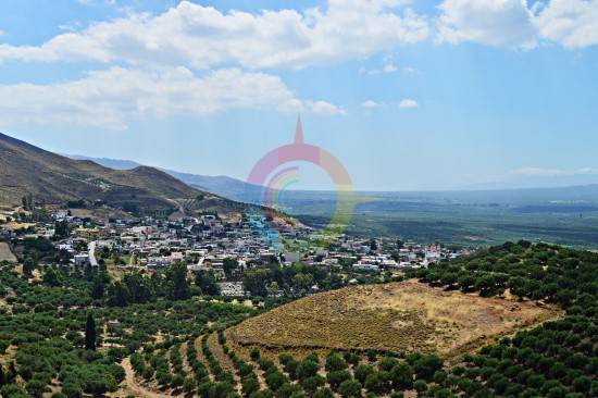
The large village of Mesochorio is in the foot of the Asphentilias hummock in the Asterousia mountains. The settlement is about 55 kilometers from Heraclion. The…

The picturesque village is on the top of a hillock next to the Anapodaris river and 240 meters above the sea level. Administratively it falls under the Archanes-…

The lake of Damania is near the Damania settlement, in Archanes-Asterousia municipality and the prefecture of Heraclion. The dam gives the landscape an extra touch…

In Kato Vrisi, in Astritsi, someone can find a forgotten part of the paradise. Administratively, Astritsi belongs to the Archanes- Asterousia Municipality,…

The gorges of Astrakias, Kunavi and Karteros are parts of the wide geographical cluster from where the E4 European long distance path passes by. Its total length…

Astraki is famous for its beautiful gorge that goes by the same name and it starts from there and also for the old Turkish quarter. The village is from the 12th…

Alagni is a village in the Archanes- Asterousia Municipality and is closely connected to mythology, history and tradition. Alagni is 25 kilometers from Heraclion,…

Location 70 km from Heraklion Altitude 900 meters History Inhabited since the Neolithic era, it remained uninhabited during the Venetian era due…

The Preveli Monastery is about 35 kilometers in the south of Rethimno and the famous and beautiful palm forest is next to it. The monastery is in the west of the…

The impressive cavern of Pelekita or “tis Sikias o Spilios” is one of the biggest caverns in Crete and of a high archaeological importance. It is about 5 kilometers…

The gorge of Nekroi in Zakros is a very beautiful and important archaeologically gorge. Its name (“nekroi” means the dead, in Greek) came from the large number…

Mirtos is a picturesque and tourist coastal settlement of the Lasithi prefecture. It is built near the banks of the Krios River, close to the exit of the imposing…

Agios NIkolaos, the beautiful capital of the Lasithi prefecture, is in the west side of the Meramvelo peninsula. The Voulismeni Lake in the center of the city is…


