


E4 Asites - Profitis Ilias
The path in the Agios Charalampos gorge is a part of the E4 European long distance route. Following the route, you can go through the impressive Agios Antonios…
34 results found
The path in the Agios Charalampos gorge is a part of the E4 European long distance route. Following the route, you can go through the impressive Agios Antonios…

Location Tavris Plateau near Askifou Altitude1,200 m Access 7.5 km dirt road or a 2-hour hike from Ammoudari Facilities 45 people capacity,…

Location Southeast of the Omalos Plateau, at an altitude of 1,680 meters View Panoramic views of the Cretan and Libyan Seas, the Samaria Gorge, and Gavdos…

Location Lake Agia is located 9 km west of Chania Size It covers an area of 450 acres Origin The lake is artificial and named after the nearby village…

Location 8 km west of Chora Sfakion Beach Features Pebbles, deep clear waters, tamarisk trees for shade Freshwater Springs Drinkable water springs…

Location 70 km southwest of Chania, built on a peninsula between two bays Sights the Venetian fortress of Selino, the Museum of the Akrites of Europe…
The twelfth route of the E4 European Long DIstance Path in Crete is 20 kilometers long and lasts about 8 to 10 hours. You can follow it from May to September, it…

Location 75 km southeast of Chania History Unsubdued by conquerors from the Arab period through the Turkish occupation Activities Hiking on the E4…

The fourteenth route of the E4 European Long Distance Path in Crete is 18 kilometers and lasts about 6 hours. You can take it during the whole year, it is not a…

The eleventh route of the E4 European Long Distance Path in Crete is 15 kilometers and lasts about 7 hours. You can follow it from the end of spring till the beginning…

The tenth route of the E4 European long distance Path is about 18 kilometers and lasts 6 hours and 30 minutes. The time it has to be followed is from May to October(due…
The ninth route of E4 European Long Distance Path is 13,5 kilometers and takes 7 hours and 30 minutes to follow it. The best season of the time to follow it is…

The eighth route of the E4 European Long Distance Path is about 24,5 kilometers and lasts 8 hours. It is better to follow it in spring or autumn, it is not a difficult…

The seventh route of the E4 European Long Distance Path is 19,5 kilometers long and lasts 5 hours and 30 minutes, You can follow it during the whole year, it has…

The sixth route of the E4 European long distance path is about 13 kilometers and lasts 3 hours and 30 minutes. The best time to take it is the whole year and, especially…

The fifth route of the E4 European Long Distance Path in Crete is 20 kilometers long and lasts 8 to 9 hours. You should follow it from April to September and the…

The fourth route of the E4 European long distance Path is about 14,5 kilometers and lasts about 4 and a half hours. The ideal time of the year in order to visit…

The third route of the E4 European long distance path is about 22 kilometers and lasts 5 hours. Its best visiting time of the year is spring, summer and autumn.…

The second route of the E4 European long distance path of Crete is 32 kilometers and lasts about 8 hours. The ideal time to visit it is spring and autumn. There…

The E4 European long distance path of Crete starts from Kasteli Kissamou of the Chania prefecture. The total length of the Kasteli Kissamou-Sfinari route is about…

Argyroupoli is one of the most beautiful villages of the Rethimno prefecture, on the hill between the springs of the Petre and Mousela Rivers after which the names…
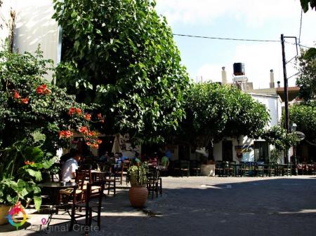
Anogeia of Milopotamos is a mountain town with important history and three holocausts. Anogeia preserves the Cretan tradition in the modern Crete. Anogeia is the…

Nida is the highest plateau in Crete as it is about 1.450 meters above the sea level and surrounded by the imposing mountains of Psiloreitis. It is a very beautiful…

Spili is a traditional, mountain settlement of the Agios Vasileios municipality in the Rethimno prefecture. The settlement is built amphitheatrically, on the western…

Location 50 km from Heraklion and 15 km from Ano Viannos Elevation 430 meters Inhabitants Approximately 430 History Mentioned r in documents…

Location 15 km from Heraklion Altitude 360 m. Activities Hiking on the E4 trail, visit to the Museum of Cretan History Sights Archaeological site in Fourni, amazing…

The gorge starts from the small Agios Charalampos church in the south of the Ano Asites settlement. The small gorge is easily accessed, particularly in the summer,…

Ano Asites is a settlement of the former Malevizi district of the Heraclion municipality. It is a village of a high environmental, cultural and archaeological interest.…

The path to the green gorge of Agios Nikolaos with the amazing waterfalls starts from the Zaros Lake and ends to one of the forest of Greece, the Rouvas forest.…

The beautiful and interesting town of Zaros is built 45 kilometers from Heraclion and is included in the Festos municipality. It is in the southern foot of the…

The gorges of Astrakias, Kunavi and Karteros are parts of the wide geographical cluster from where the E4 European long distance path passes by. Its total length…

The gorge of Nekroi in Zakros is a very beautiful and important archaeologically gorge. Its name (“nekroi” means the dead, in Greek) came from the large number…


