


Nida plateau
Nida is the highest plateau in Crete as it is about 1.450 meters above the sea level and surrounded by the imposing mountains of Psiloreitis. It is a very beautiful…
26 results found
Nida is the highest plateau in Crete as it is about 1.450 meters above the sea level and surrounded by the imposing mountains of Psiloreitis. It is a very beautiful…

Location 70 km from Heraklion Altitude 900 meters History Inhabited since the Neolithic era, it remained uninhabited during the Venetian era due…

River is a system of internal water that flows on the surface of the earth and a large of its part can be underground. Very few rivers are in Crete due to its small…

Mitato is a small stone-shaped building. Mitato you can find in the mountains of Crete and in Cyclades. These are buildings reminiscent of circular Minoan tombs…

Crete has been popular for summer holidays but that is not only the case. Crete is also a winter destination just as any other in the world. Crete, the island of…

Location Tavris Plateau near Askifou Altitude1,200 m Access 7.5 km dirt road or a 2-hour hike from Ammoudari Facilities 45 people capacity,…

Location Southeast of the Omalos Plateau, at an altitude of 1,680 meters View Panoramic views of the Cretan and Libyan Seas, the Samaria Gorge, and Gavdos…

Location South of Sfakia, 75 km from Chania. Historical Interest Venetian castle and the legend of the Drosoulites. Beaches Main beach, Orthi Ammos,…

The twelfth route of the E4 European Long DIstance Path in Crete is 20 kilometers long and lasts about 8 to 10 hours. You can follow it from May to September, it…

Location 42 km south of Chania city Length 18 kilometers, with a hiking duration of 4-8 hours National Park Declared in 1962, part of the UNESCO…
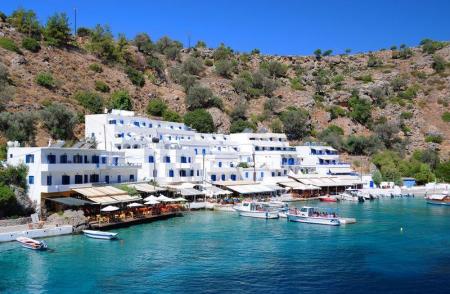
Location 2 km east of Chora Sfakion Natural Landscape Rocky terrain, steep cliffs, rich flora with holm oaks, pines, cypresses, and stone pines Hiking The…

The fourteenth route of the E4 European Long Distance Path in Crete is 18 kilometers and lasts about 6 hours. You can take it during the whole year, it is not a…

The tenth route of the E4 European long distance Path is about 18 kilometers and lasts 6 hours and 30 minutes. The time it has to be followed is from May to October(due…

The ninth route of E4 European Long Distance Path is 13,5 kilometers and takes 7 hours and 30 minutes to follow it. The best season of the time to follow it is…

The Monastery of Arkadi combines the natural beauty with its important history and legends. It is about 23 kilometers from Rethimno, in a very green plateau, in…

The Idaion Antron is near the picturesque town of Anogeia with the important history and the impressive myths. The cavern is 1500 meters above the sea level and…
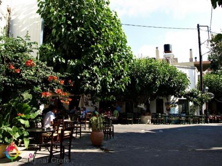
Anogeia of Milopotamos is a mountain town with important history and three holocausts. Anogeia preserves the Cretan tradition in the modern Crete. Anogeia is the…

Location 18 km west of Heraklion, at an altitude of 440 meters History Founded by Venetians, it retains many architectural features from that period Residents 50…

Location 53 km from Heraklion, on the southern slopes of Mount Psiloritis Attractions The Monastery of Varsamonero, dating back to the 18th century, is…

The path from the Kamares settlement ends to the large and impressive Kamares cavern. The visitor walks between a dense forest of oaks. The total time to the end…

The entrance of the gorge of Vorizia is in a dense planted area full of oaks, in the east of Vorizia. The gorge ends to the amazing landscapes of the Nida plateau.…

In Kato Vrisi, in Astritsi, someone can find a forgotten part of the paradise. Administratively, Astritsi belongs to the Archanes- Asterousia Municipality,…

Location Situated at the eastern edge of the Ziros Plateau, 31 km from Sitia Settlements Includes Agia Irini, Agrilia, Kalo Chorio, Lamnoni, Xerokampos,…


